Lanser Kopf
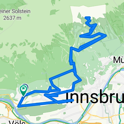
A cycling route starting in Völs, Tyrol, Austria.
Overview
About this route
kurze MTB Ausfahrt von Innsbruck auf den Lanser Kopf.
ideal, wenn man wenig Zeit hat, oder wenn es weiter oben, wetterbedingt, noch nicht ideal zum Fahren ist.
- -:--
- Duration
- 26.6 km
- Distance
- 387 m
- Ascent
- 384 m
- Descent
- ---
- Avg. speed
- ---
- Avg. speed
Route quality
Waytypes & surfaces along the route
Waytypes
Undefined
26.6 km
(100 %)
Surfaces
Undefined
26.6 km
(100 %)
Continue with Bikemap
Use, edit, or download this cycling route
You would like to ride Lanser Kopf or customize it for your own trip? Here is what you can do with this Bikemap route:
Free features
- Save this route as favorite or in collections
- Copy & plan your own version of this route
- Sync your route with Garmin or Wahoo
Premium features
Free trial for 3 days, or one-time payment. More about Bikemap Premium.
- Navigate this route on iOS & Android
- Export a GPX / KML file of this route
- Create your custom printout (try it for free)
- Download this route for offline navigation
Discover more Premium features.
Get Bikemap PremiumFrom our community
Other popular routes starting in Völs
- Wipptalrunde
- Distance
- 48.4 km
- Ascent
- 705 m
- Descent
- 707 m
- Location
- Völs, Tyrol, Austria
- Völs-Kematen-Sellrain-Gries-St. Sigmund-Haggen-Kühtai-Ötz-und zurück
- Distance
- 92.1 km
- Ascent
- 3,151 m
- Descent
- 3,140 m
- Location
- Völs, Tyrol, Austria
- Innsbruck - Scuol
- Distance
- 138.5 km
- Ascent
- 1,050 m
- Descent
- 372 m
- Location
- Völs, Tyrol, Austria
- Inn túra 6.nap
- Distance
- 89.3 km
- Ascent
- 29 m
- Descent
- 119 m
- Location
- Völs, Tyrol, Austria
- Kühtai Sattel 2009
- Distance
- 55.3 km
- Ascent
- 1,805 m
- Descent
- 1,740 m
- Location
- Völs, Tyrol, Austria
- INNSBRUCK - STERZING (stadtplatz)
- Distance
- 58 km
- Ascent
- 994 m
- Descent
- 621 m
- Location
- Völs, Tyrol, Austria
- Campingplatz Kranebitten - Höttinger Alm
- Distance
- 12.8 km
- Ascent
- 996 m
- Descent
- 122 m
- Location
- Völs, Tyrol, Austria
- Alpequer3
- Distance
- 237.3 km
- Ascent
- 4,005 m
- Descent
- 4,180 m
- Location
- Völs, Tyrol, Austria