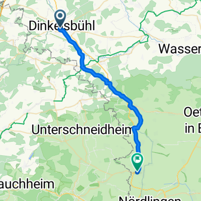
Citytriathlon Dinkelsbühl 2014 (Radstrecke)
- 10.1 km
- 91 m
- 91 m
- Dinkelsbühl, Bavaria, Germany
A cycling route starting in Dinkelsbühl, Bavaria, Germany.
Overview
Fraischgrenze.
Die Fahrradtour folg den Spuren der Gemarkungsgrenze von 1476 wie sie die Dinkelsbühler von je her abgeritten sind.
Bei dieser Rundfahrt trifft man auf wunderschöne Bildstöcke, mächtige Grenzmarken wie das „Weiße Kreuz“ auf Erdwälle die mit Bäumen bepflanzt waren in der Mutschach, Landgräben und Weiherketten, Dörfer und ehemalige Mühlstätten die alle ehemals das Stadtgebiet umrandeten.
created this 7 years ago


Continue with Bikemap
You would like to ride Fraischgrenze or customize it for your own trip? Here is what you can do with this Bikemap route:
Free trial for 3 days, or one-time payment. More about Bikemap Premium.
Discover more Premium features.
Get Bikemap PremiumFrom our community
Open it in the app