

Dookoła Tatr maj 2018
A cycling route starting in Kościelisko, Lesser Poland Voivodeship, Poland.
Overview
About this route
- -:--
- Duration
- 241.6 km
- Distance
- 1,898 m
- Ascent
- 2,108 m
- Descent
- ---
- Avg. speed
- ---
- Max. altitude

Route quality
Waytypes & surfaces along the route
Waytypes
Quiet road
41.1 km
(17 %)
Road
29 km
(12 %)
Surfaces
Paved
164.3 km
(68 %)
Unpaved
7.2 km
(3 %)
Asphalt
161.9 km
(67 %)
Gravel
7.2 km
(3 %)
Route highlights
Points of interest along the route

Photo after 0 km
Kościelisko

Photo after 21.9 km
Granica

Point of interest after 77.6 km
Zjazd z 1074 m.n.p.m.

Point of interest after 91.5 km
Liptovska Mara

Photo after 135.7 km
Burza nad Krywaniem

Photo after 137.7 km
Krivań

Point of interest after 151.3 km
Strbskie Pleso

Point of interest after 153 km
Małe Strbskie Pleso

Photo after 164 km
Tartry Wysokie

Photo after 166.3 km
Slavkowsky Stit 2452 m.n.n.p.

Photo after 176.9 km
Widok Na Łomnicę 2634 m.n.p.m.

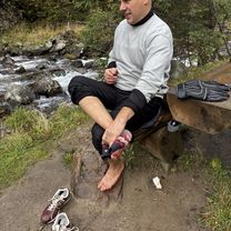
Photo after 179.8 km
Odpoczynek

Photo after 194.8 km
Widok Na Tatry Bielskie

Photo after 208.1 km
Już w Polsce

Point of interest after 219.4 km
Widok na Giewont z Cyhrli
Continue with Bikemap
Use, edit, or download this cycling route
You would like to ride Dookoła Tatr maj 2018 or customize it for your own trip? Here is what you can do with this Bikemap route:
Free features
- Save this route as favorite or in collections
- Copy & plan your own version of this route
- Split it into stages to create a multi-day tour
- Sync your route with Garmin or Wahoo
Premium features
Free trial for 3 days, or one-time payment. More about Bikemap Premium.
- Navigate this route on iOS & Android
- Export a GPX / KML file of this route
- Create your custom printout (try it for free)
- Download this route for offline navigation
Discover more Premium features.
Get Bikemap PremiumFrom our community
Other popular routes starting in Kościelisko
 Chochołów - Euroregion Tatry Tour (I etap)
- Distance
- 48.9 km
- Ascent
- 497 m
- Descent
- 552 m
- Location
- Kościelisko, Lesser Poland Voivodeship, Poland
 Single SRP 2015
- Distance
- 44.1 km
- Ascent
- 1,180 m
- Descent
- 1,180 m
- Location
- Kościelisko, Lesser Poland Voivodeship, Poland
 D3 Velo Małopolska 2020
- Distance
- 130.9 km
- Ascent
- 551 m
- Descent
- 1,258 m
- Location
- Kościelisko, Lesser Poland Voivodeship, Poland
 Dookoła Tatr maj 2018
- Distance
- 241.6 km
- Ascent
- 1,898 m
- Descent
- 2,108 m
- Location
- Kościelisko, Lesser Poland Voivodeship, Poland
 Wokół Tatr
- Distance
- 180.5 km
- Ascent
- 1,808 m
- Descent
- 1,807 m
- Location
- Kościelisko, Lesser Poland Voivodeship, Poland
 KTW 2014
- Distance
- 172.8 km
- Ascent
- 1,625 m
- Descent
- 1,775 m
- Location
- Kościelisko, Lesser Poland Voivodeship, Poland
 Siwa, Kościelisko do Witów, Kościelisko
- Distance
- 15.8 km
- Ascent
- 554 m
- Descent
- 520 m
- Location
- Kościelisko, Lesser Poland Voivodeship, Poland
 Tatry Tour - Za5Team
- Distance
- 196.6 km
- Ascent
- 1,825 m
- Descent
- 1,829 m
- Location
- Kościelisko, Lesser Poland Voivodeship, Poland
Open it in the app