

Grünes Dach
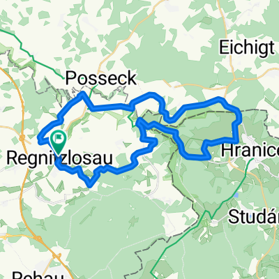
A cycling route starting in Regnitzlosau, Bavaria, Germany.
Overview
About this route
- -:--
- Duration
- 299.7 km
- Distance
- 1,724 m
- Ascent
- 1,531 m
- Descent
- ---
- Avg. speed
- ---
- Avg. speed
Route quality
Waytypes & surfaces along the route
Waytypes
Quiet road
110.3 km
(37 %)
Track
65.8 km
(22 %)
Surfaces
Paved
156.7 km
(52 %)
Unpaved
74.1 km
(25 %)
Asphalt
137.4 km
(46 %)
Gravel
63.7 km
(21 %)
Continue with Bikemap
Use, edit, or download this cycling route
You would like to ride Grünes Dach or customize it for your own trip? Here is what you can do with this Bikemap route:
Free features
- Save this route as favorite or in collections
- Copy & plan your own version of this route
- Split it into stages to create a multi-day tour
- Sync your route with Garmin or Wahoo
Premium features
Free trial for 3 days, or one-time payment. More about Bikemap Premium.
- Navigate this route on iOS & Android
- Export a GPX / KML file of this route
- Create your custom printout (try it for free)
- Download this route for offline navigation
Discover more Premium features.
Get Bikemap PremiumFrom our community
Other popular routes starting in Regnitzlosau
 Grenzerfahrungen Teil 01 #BETA#
- Distance
- 94.9 km
- Ascent
- 729 m
- Descent
- 832 m
- Location
- Regnitzlosau, Bavaria, Germany
 Europa-Radweg 13 Deutschland
- Distance
- 1,507.6 km
- Ascent
- 1,769 m
- Descent
- 2,302 m
- Location
- Regnitzlosau, Bavaria, Germany
 Um Regnitzlosau III
- Distance
- 31.4 km
- Ascent
- 334 m
- Descent
- 334 m
- Location
- Regnitzlosau, Bavaria, Germany
 GB01 DLE Ludwigsstadt
- Distance
- 91 km
- Ascent
- 939 m
- Descent
- 1,054 m
- Location
- Regnitzlosau, Bavaria, Germany
 Esterbauer route
- Distance
- 1,673.4 km
- Ascent
- 1,950 m
- Descent
- 2,415 m
- Location
- Regnitzlosau, Bavaria, Germany
 Um Regnitzlosau I
- Distance
- 27.8 km
- Ascent
- 267 m
- Descent
- 267 m
- Location
- Regnitzlosau, Bavaria, Germany
 Grünes Band
- Distance
- 1,131.8 km
- Ascent
- 8,043 m
- Descent
- 8,588 m
- Location
- Regnitzlosau, Bavaria, Germany
 Raitschin - Faßmannsreuth
- Distance
- 12 km
- Ascent
- 76 m
- Descent
- 149 m
- Location
- Regnitzlosau, Bavaria, Germany
Open it in the app