

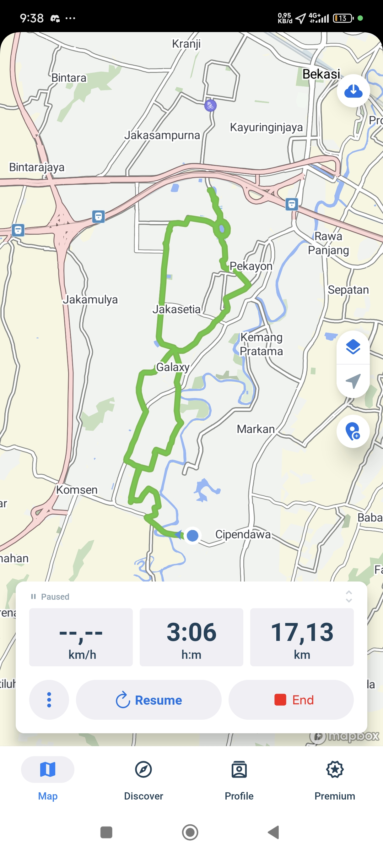
kota wisata jj treck
A cycling route starting in Bekasi, West Java, Indonesia.
Overview
About this route
- 1 h 3 min
- Duration
- 21.5 km
- Distance
- 512 m
- Ascent
- 521 m
- Descent
- 20.4 km/h
- Avg. speed
- ---
- Max. altitude

Route photos


Route quality
Waytypes & surfaces along the route
Waytypes
Quiet road
8.8 km
(41 %)
Road
5.4 km
(25 %)
Surfaces
Paved
0.9 km
(4 %)
Unpaved
0.2 km
(1 %)
Concrete
0.9 km
(4 %)
Unpaved (undefined)
0.2 km
(1 %)
Undefined
20.4 km
(95 %)
Continue with Bikemap
Use, edit, or download this cycling route
You would like to ride kota wisata jj treck or customize it for your own trip? Here is what you can do with this Bikemap route:
Free features
- Save this route as favorite or in collections
- Copy & plan your own version of this route
- Sync your route with Garmin or Wahoo
Premium features
Free trial for 3 days, or one-time payment. More about Bikemap Premium.
- Navigate this route on iOS & Android
- Export a GPX / KML file of this route
- Create your custom printout (try it for free)
- Download this route for offline navigation
Discover more Premium features.
Get Bikemap PremiumFrom our community
Other popular routes starting in Bekasi
 PX49+64G to Jalan Raya Bojong Menteng No.
- Distance
- 17.2 km
- Ascent
- 375 m
- Descent
- 404 m
- Location
- Bekasi, West Java, Indonesia
 Jalan Klayan IV 9, Kecamatan Pondokgede to Jalan Lebaksiuh, Kecamatan Setu
- Distance
- 42.5 km
- Ascent
- 322 m
- Descent
- 309 m
- Location
- Bekasi, West Java, Indonesia
 Jalan Sepakat Raya to Jalan Kemang Pratama Raya No. B9
- Distance
- 7.4 km
- Ascent
- 88 m
- Descent
- 142 m
- Location
- Bekasi, West Java, Indonesia
 kota wisata jj treck
- Distance
- 21.5 km
- Ascent
- 512 m
- Descent
- 521 m
- Location
- Bekasi, West Java, Indonesia
 Kecamatan Cilincing to Jalan Sakura no.10, Kecamatan Cakung
- Distance
- 12.4 km
- Ascent
- 91 m
- Descent
- 93 m
- Location
- Bekasi, West Java, Indonesia
 maen sawah di Nagrak ciangsana
- Distance
- 56 km
- Ascent
- 425 m
- Descent
- 426 m
- Location
- Bekasi, West Java, Indonesia
 Jalan Kelapa Sawit Raya, East Jakarta to Jalan Kelapa Sawit Raya, East Jakarta
- Distance
- 46.6 km
- Ascent
- 142 m
- Descent
- 142 m
- Location
- Bekasi, West Java, Indonesia
 Jalan Anggrek 3 14, Kecamatan Tambun Selatan to Jalan Setiamekar No.18, Kecamatan Tambun Selatan
- Distance
- 10.2 km
- Ascent
- 66 m
- Descent
- 74 m
- Location
- Bekasi, West Java, Indonesia
Open it in the app