

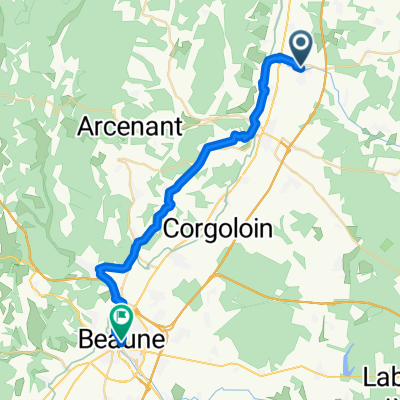
nuits malaucène
A cycling route starting in Nuits-Saint-Georges, Bourgogne-Franche-Comté, France.
Overview
About this route
- -:--
- Duration
- 790.8 km
- Distance
- 6,292 m
- Ascent
- 6,304 m
- Descent
- ---
- Avg. speed
- ---
- Max. altitude

Route quality
Waytypes & surfaces along the route
Waytypes
Busy road
418.3 km
(53 %)
Road
213 km
(27 %)
Surfaces
Paved
438.6 km
(55 %)
Unpaved
2 km
(<1 %)
Asphalt
436.2 km
(55 %)
Paved (undefined)
1.7 km
(<1 %)
Route highlights
Points of interest along the route
Point of interest after 136.1 km
Camping Domaine de la Dombes (sitecode: 59841) Camperplaats St. Paul-de-Varax / Rhone Alpes [01-07-26-38-42-69-73-74] / Frankrijk
Point of interest after 265.8 km
Aire Municipale (sitecode: 22573) Camperplaats Sassenage / Rhone Alpes [01-07-26-38-42-69-73-74] / Frankrijk
Point of interest after 378.3 km
Parking (sitecode: 47149) Camperplaats St. Colomban-des-Villards / Rhone Alpes [01-07-26-38-42-69-73-74] / Frankrijk
Point of interest after 381.5 km
Parking Col du Glandon (sitecode: 2304) Camperplaats St. Jean d'Arves / Rhone Alpes [01-07-26-38-42-69-73-74] / Frankrijk
Point of interest after 519.9 km
Camping des Allouviers (sitecode: 59404) Camperplaats Freissinières / Provence/Alpes/Cote-d'Azur [04-05-06-13-83-84] / Frankrijk
Point of interest after 520.9 km
Camping du Lac (sitecode: 59396) Camperplaats La Roche-de- Rame / Provence/Alpes/Cote-d'Azur [04-05-06-13-83-84] / Frankrijk
Point of interest after 636.9 km
Camping Les Pres Hauts (sitecode: 49871) Camperplaats Sisteron / Provence/Alpes/Cote-d'Azur [04-05-06-13-83-84] / Frankrijk
Continue with Bikemap
Use, edit, or download this cycling route
You would like to ride nuits malaucène or customize it for your own trip? Here is what you can do with this Bikemap route:
Free features
- Save this route as favorite or in collections
- Copy & plan your own version of this route
- Split it into stages to create a multi-day tour
- Sync your route with Garmin or Wahoo
Premium features
Free trial for 3 days, or one-time payment. More about Bikemap Premium.
- Navigate this route on iOS & Android
- Export a GPX / KML file of this route
- Create your custom printout (try it for free)
- Download this route for offline navigation
Discover more Premium features.
Get Bikemap PremiumFrom our community
Other popular routes starting in Nuits-Saint-Georges
 Gilly to Beaune pomalsie
- Distance
- 28 km
- Ascent
- 278 m
- Descent
- 281 m
- Location
- Nuits-Saint-Georges, Bourgogne-Franche-Comté, France
 Nuit St Georges Round trip
- Distance
- 88.4 km
- Ascent
- 1,067 m
- Descent
- 1,033 m
- Location
- Nuits-Saint-Georges, Bourgogne-Franche-Comté, France
 11998158-Circuit n°09 : la côte de Nuit
- Distance
- 55.4 km
- Ascent
- 747 m
- Descent
- 745 m
- Location
- Nuits-Saint-Georges, Bourgogne-Franche-Comté, France
 • C Nuits-Dijon-Nuits
- Distance
- 54.8 km
- Ascent
- 233 m
- Descent
- 233 m
- Location
- Nuits-Saint-Georges, Bourgogne-Franche-Comté, France
 nuits malaucène
- Distance
- 790.8 km
- Ascent
- 6,292 m
- Descent
- 6,304 m
- Location
- Nuits-Saint-Georges, Bourgogne-Franche-Comté, France
 Vosne Romanée 10km
- Distance
- 10.2 km
- Ascent
- 173 m
- Descent
- 171 m
- Location
- Nuits-Saint-Georges, Bourgogne-Franche-Comté, France
 17–19 Grande Rue, Comblanchien à 8 Route de la Serrée, Nuits-Saint-Georges
- Distance
- 8.1 km
- Ascent
- 94 m
- Descent
- 63 m
- Location
- Nuits-Saint-Georges, Bourgogne-Franche-Comté, France
 vougeot---dracy le fort
- Distance
- 58.5 km
- Ascent
- 341 m
- Descent
- 382 m
- Location
- Nuits-Saint-Georges, Bourgogne-Franche-Comté, France
Open it in the app