

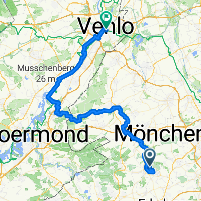
Mühlentur
A cycling route starting in Wegberg, North Rhine-Westphalia, Germany.
Overview
About this route
- 1 h 54 min
- Duration
- 16.9 km
- Distance
- 357 m
- Ascent
- 320 m
- Descent
- 8.9 km/h
- Avg. speed
- ---
- Max. altitude

Route quality
Waytypes & surfaces along the route
Waytypes
Path
9.1 km
(54 %)
Quiet road
4.4 km
(26 %)
Surfaces
Paved
4.2 km
(25 %)
Unpaved
1 km
(6 %)
Asphalt
4.2 km
(25 %)
Ground
0.7 km
(4 %)
Continue with Bikemap
Use, edit, or download this cycling route
You would like to ride Mühlentur or customize it for your own trip? Here is what you can do with this Bikemap route:
Free features
- Save this route as favorite or in collections
- Copy & plan your own version of this route
- Sync your route with Garmin or Wahoo
Premium features
Free trial for 3 days, or one-time payment. More about Bikemap Premium.
- Navigate this route on iOS & Android
- Export a GPX / KML file of this route
- Create your custom printout (try it for free)
- Download this route for offline navigation
Discover more Premium features.
Get Bikemap PremiumFrom our community
Other popular routes starting in Wegberg
 ALL-Priorshof-RYStadium
- Distance
- 10.8 km
- Ascent
- 44 m
- Descent
- 64 m
- Location
- Wegberg, North Rhine-Westphalia, Germany
 50plus Route 2018
- Distance
- 37.1 km
- Ascent
- 109 m
- Descent
- 109 m
- Location
- Wegberg, North Rhine-Westphalia, Germany
 1.tag
1.tag- Distance
- 24 km
- Ascent
- 102 m
- Descent
- 52 m
- Location
- Wegberg, North Rhine-Westphalia, Germany
 Schwalm-Nette Maas Radtour
- Distance
- 62.9 km
- Ascent
- 82 m
- Descent
- 125 m
- Location
- Wegberg, North Rhine-Westphalia, Germany
 Mühlenroute CLONED FROM ROUTE 353682
- Distance
- 36.1 km
- Ascent
- 83 m
- Descent
- 82 m
- Location
- Wegberg, North Rhine-Westphalia, Germany
 Mühlentur
- Distance
- 16.9 km
- Ascent
- 357 m
- Descent
- 320 m
- Location
- Wegberg, North Rhine-Westphalia, Germany
 Dag 4 onsdag 4.7.18
- Distance
- 222.9 km
- Ascent
- 520 m
- Descent
- 478 m
- Location
- Wegberg, North Rhine-Westphalia, Germany
 Wegberg Garzweiler Tagebau
- Distance
- 21.1 km
- Ascent
- 76 m
- Descent
- 36 m
- Location
- Wegberg, North Rhine-Westphalia, Germany
Open it in the app