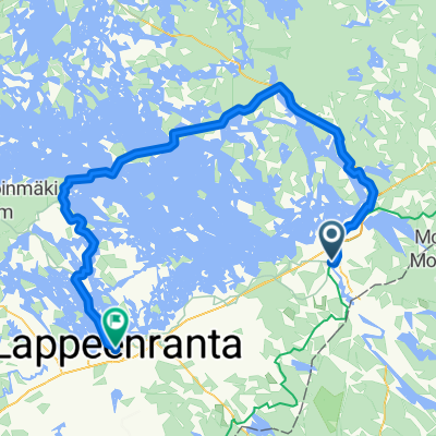
Петля Иматра ~100 км
A cycling route starting in Imatra, South Karelia, Finland.
Overview
About this route
- -:--
- Duration
- 97.2 km
- Distance
- 578 m
- Ascent
- 577 m
- Descent
- ---
- Avg. speed
- 119 m
- Max. altitude
Continue with Bikemap
Use, edit, or download this cycling route
You would like to ride Петля Иматра ~100 км or customize it for your own trip? Here is what you can do with this Bikemap route:
Free features
- Save this route as favorite or in collections
- Copy & plan your own version of this route
- Split it into stages to create a multi-day tour
- Sync your route with Garmin or Wahoo
Premium features
Free trial for 3 days, or one-time payment. More about Bikemap Premium.
- Navigate this route on iOS & Android
- Export a GPX / KML file of this route
- Create your custom printout (try it for free)
- Download this route for offline navigation
Discover more Premium features.
Get Bikemap PremiumFrom our community
Other popular routes starting in Imatra
- Close to Imatra
- Distance
- 54.6 km
- Ascent
- 201 m
- Descent
- 161 m
- Location
- Imatra, South Karelia, Finland
- finland
- Distance
- 494 km
- Ascent
- 396 m
- Descent
- 430 m
- Location
- Imatra, South Karelia, Finland
- svet-parikkala-svet
- Distance
- 183.4 km
- Ascent
- 0 m
- Descent
- 0 m
- Location
- Imatra, South Karelia, Finland
- Imatra2018
- Distance
- 193 km
- Ascent
- 0 m
- Descent
- 0 m
- Location
- Imatra, South Karelia, Finland
- Петля Иматра ~100 км
- Distance
- 97.2 km
- Ascent
- 578 m
- Descent
- 577 m
- Location
- Imatra, South Karelia, Finland
- 2011, august, 27-28th
- Distance
- 150.4 km
- Ascent
- 345 m
- Descent
- 340 m
- Location
- Imatra, South Karelia, Finland
- Saimaa lake draft
- Distance
- 31.2 km
- Ascent
- 0 m
- Descent
- 0 m
- Location
- Imatra, South Karelia, Finland
- savonlina
- Distance
- 286 km
- Ascent
- 343 m
- Descent
- 329 m
- Location
- Imatra, South Karelia, Finland
Open it in the app