

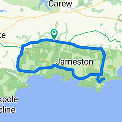
Par Farm - Tenby - Park Farm
A cycling route starting in Manorbier, Wales, United Kingdom.
Overview
About this route
- -:--
- Duration
- 17.9 km
- Distance
- 204 m
- Ascent
- 200 m
- Descent
- ---
- Avg. speed
- ---
- Max. altitude

Route quality
Waytypes & surfaces along the route
Waytypes
Road
10.6 km
(60 %)
Access road
3.2 km
(18 %)
Surfaces
Paved
13.9 km
(78 %)
Asphalt
13.9 km
(78 %)
Undefined
4 km
(22 %)
Continue with Bikemap
Use, edit, or download this cycling route
You would like to ride Par Farm - Tenby - Park Farm or customize it for your own trip? Here is what you can do with this Bikemap route:
Free features
- Save this route as favorite or in collections
- Copy & plan your own version of this route
- Sync your route with Garmin or Wahoo
Premium features
Free trial for 3 days, or one-time payment. More about Bikemap Premium.
- Navigate this route on iOS & Android
- Export a GPX / KML file of this route
- Create your custom printout (try it for free)
- Download this route for offline navigation
Discover more Premium features.
Get Bikemap PremiumFrom our community
Other popular routes starting in Manorbier
 B4585, Manorbier, Tenby to Greenway House, Station Road, Narberth
- Distance
- 28.5 km
- Ascent
- 527 m
- Descent
- 460 m
- Location
- Manorbier, Wales, United Kingdom
 Route from A4139, Tenby
- Distance
- 8.2 km
- Ascent
- 89 m
- Descent
- 142 m
- Location
- Manorbier, Wales, United Kingdom
 West Hall, High St, Tenby to Dewslake Farm, The Ridgeway, Pembroke
- Distance
- 14.5 km
- Ascent
- 513 m
- Descent
- 513 m
- Location
- Manorbier, Wales, United Kingdom
 West Hall, High St, Tenby to Stackpole and Castlemartin Community, Pembroke
- Distance
- 18.1 km
- Ascent
- 209 m
- Descent
- 193 m
- Location
- Manorbier, Wales, United Kingdom
 Ridgeway Manorbier loop
- Distance
- 21 km
- Ascent
- 232 m
- Descent
- 232 m
- Location
- Manorbier, Wales, United Kingdom
 Par Farm - Tenby - Park Farm
- Distance
- 17.9 km
- Ascent
- 204 m
- Descent
- 200 m
- Location
- Manorbier, Wales, United Kingdom
 Manorbier to Narbeth
- Distance
- 26.4 km
- Ascent
- 400 m
- Descent
- 344 m
- Location
- Manorbier, Wales, United Kingdom
 Tenby - Haverfordwest
- Distance
- 31.1 km
- Ascent
- 246 m
- Descent
- 296 m
- Location
- Manorbier, Wales, United Kingdom
Open it in the app