

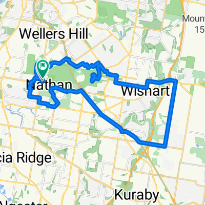
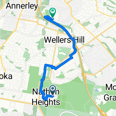
Nathan-Mt G-Gardner-V1-ring road-nathan
A cycling route starting in Tarragindi, Queensland, Australia.
Overview
About this route
- -:--
- Duration
- 32.9 km
- Distance
- 380 m
- Ascent
- 380 m
- Descent
- ---
- Avg. speed
- ---
- Max. altitude
Route quality
Waytypes & surfaces along the route
Waytypes
Road
10.6 km
(32 %)
Quiet road
10 km
(31 %)
Surfaces
Paved
32.1 km
(98 %)
Asphalt
23.1 km
(70 %)
Concrete
7.6 km
(23 %)
Continue with Bikemap
Use, edit, or download this cycling route
You would like to ride Nathan-Mt G-Gardner-V1-ring road-nathan or customize it for your own trip? Here is what you can do with this Bikemap route:
Free features
- Save this route as favorite or in collections
- Copy & plan your own version of this route
- Sync your route with Garmin or Wahoo
Premium features
Free trial for 3 days, or one-time payment. More about Bikemap Premium.
- Navigate this route on iOS & Android
- Export a GPX / KML file of this route
- Create your custom printout (try it for free)
- Download this route for offline navigation
Discover more Premium features.
Get Bikemap PremiumFrom our community
Other popular routes starting in Tarragindi
 River Loop
- Distance
- 69.4 km
- Ascent
- 262 m
- Descent
- 302 m
- Location
- Tarragindi, Queensland, Australia
 Nathan-Mt G-Gardner-V1-ring road-nathan
- Distance
- 32.9 km
- Ascent
- 380 m
- Descent
- 380 m
- Location
- Tarragindi, Queensland, Australia
 royal brisbane hospital
- Distance
- 6.4 km
- Ascent
- 87 m
- Descent
- 113 m
- Location
- Tarragindi, Queensland, Australia
 Recovered Route
- Distance
- 26.6 km
- Ascent
- 314 m
- Descent
- 303 m
- Location
- Tarragindi, Queensland, Australia
 River Loop Gateway Bridge
- Distance
- 46.1 km
- Ascent
- 193 m
- Descent
- 193 m
- Location
- Tarragindi, Queensland, Australia
 Rec ride
- Distance
- 8.8 km
- Ascent
- 62 m
- Descent
- 55 m
- Location
- Tarragindi, Queensland, Australia
 Wynnum
- Distance
- 82.5 km
- Ascent
- 307 m
- Descent
- 281 m
- Location
- Tarragindi, Queensland, Australia
 Tarragindi to Brisbane CBD
- Distance
- 8.5 km
- Ascent
- 66 m
- Descent
- 140 m
- Location
- Tarragindi, Queensland, Australia
Open it in the app