

Étang de Lindre
A cycling route starting in Villers-lès-Nancy, Grand Est, France.
Overview
About this route
A fairly long but essentially flat loop (the elevation gain is actually 860 m) that avoids main roads as much as possible. The Lindre pond is known for the birds that can be observed there, and its stork nests.
- -:--
- Duration
- 130.5 km
- Distance
- 237 m
- Ascent
- 237 m
- Descent
- ---
- Avg. speed
- ---
- Max. altitude
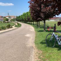
Route photos

Route quality
Waytypes & surfaces along the route
Waytypes
Path
33.9 km
(26 %)
Road
30 km
(23 %)
Surfaces
Paved
101.8 km
(78 %)
Unpaved
1.3 km
(1 %)
Asphalt
95.3 km
(73 %)
Paved (undefined)
6.5 km
(5 %)
Continue with Bikemap
Use, edit, or download this cycling route
You would like to ride Étang de Lindre or customize it for your own trip? Here is what you can do with this Bikemap route:
Free features
- Save this route as favorite or in collections
- Copy & plan your own version of this route
- Split it into stages to create a multi-day tour
- Sync your route with Garmin or Wahoo
Premium features
Free trial for 3 days, or one-time payment. More about Bikemap Premium.
- Navigate this route on iOS & Android
- Export a GPX / KML file of this route
- Create your custom printout (try it for free)
- Download this route for offline navigation
Discover more Premium features.
Get Bikemap PremiumFrom our community
Other popular routes starting in Villers-lès-Nancy
 Hattonchâtel
- Distance
- 79 km
- Ascent
- 456 m
- Descent
- 342 m
- Location
- Villers-lès-Nancy, Grand Est, France
 Étang de Lindre
- Distance
- 130.5 km
- Ascent
- 237 m
- Descent
- 237 m
- Location
- Villers-lès-Nancy, Grand Est, France
 Nancy - St. Mihiel
- Distance
- 77 km
- Ascent
- 532 m
- Descent
- 546 m
- Location
- Villers-lès-Nancy, Grand Est, France
 Un p’tit bout de Meuse
- Distance
- 129.3 km
- Ascent
- 1,337 m
- Descent
- 1,337 m
- Location
- Villers-lès-Nancy, Grand Est, France
 Nancy - Bèze (Côte d’Or)
- Distance
- 243.1 km
- Ascent
- 1,631 m
- Descent
- 1,648 m
- Location
- Villers-lès-Nancy, Grand Est, France
 Côte de Toul - Gélaucourt
- Distance
- 101.9 km
- Ascent
- 1,050 m
- Descent
- 1,051 m
- Location
- Villers-lès-Nancy, Grand Est, France
 nancy - maron - liverdun
- Distance
- 56.9 km
- Ascent
- 482 m
- Descent
- 485 m
- Location
- Villers-lès-Nancy, Grand Est, France
 Bitche
- Distance
- 132.4 km
- Ascent
- 632 m
- Descent
- 545 m
- Location
- Villers-lès-Nancy, Grand Est, France
Open it in the app