2018 St Die-des-Vosges to Col du Donon and back
A cycling route starting in Saint-Dié, Grand Est, France.
Overview
About this route
Lovely area, not visited in 2017, known to Don and I through Sun Run; moderate. Drive to start, 36 kms and 50 minutes
- -:--
- Duration
- 102.6 km
- Distance
- 1,389 m
- Ascent
- 1,391 m
- Descent
- ---
- Avg. speed
- ---
- Max. altitude
Route quality
Waytypes & surfaces along the route
Waytypes
Road
23.6 km
(23 %)
Quiet road
23.6 km
(23 %)
Surfaces
Paved
41 km
(40 %)
Unpaved
1 km
(1 %)
Asphalt
41 km
(40 %)
Gravel
1 km
(1 %)
Undefined
60.5 km
(59 %)
Continue with Bikemap
Use, edit, or download this cycling route
You would like to ride 2018 St Die-des-Vosges to Col du Donon and back or customize it for your own trip? Here is what you can do with this Bikemap route:
Free features
- Save this route as favorite or in collections
- Copy & plan your own version of this route
- Split it into stages to create a multi-day tour
- Sync your route with Garmin or Wahoo
Premium features
Free trial for 3 days, or one-time payment. More about Bikemap Premium.
- Navigate this route on iOS & Android
- Export a GPX / KML file of this route
- Create your custom printout (try it for free)
- Download this route for offline navigation
Discover more Premium features.
Get Bikemap PremiumFrom our community
Other popular routes starting in Saint-Dié
Vogesen Route- Distance
- 219.9 km
- Ascent
- 4,883 m
- Descent
- 3,888 m
- Location
- Saint-Dié, Grand Est, France
final route- Distance
- 210 km
- Ascent
- 4,601 m
- Descent
- 3,759 m
- Location
- Saint-Dié, Grand Est, France
2018 St Die-des-Vosges to Col du Donon and back- Distance
- 102.6 km
- Ascent
- 1,389 m
- Descent
- 1,391 m
- Location
- Saint-Dié, Grand Est, France
Stage 1 Europa's Ziekste ALT- Distance
- 155.4 km
- Ascent
- 2,103 m
- Descent
- 1,987 m
- Location
- Saint-Dié, Grand Est, France
2007-10-13 Saint Dié- Distance
- 45.2 km
- Ascent
- 1,013 m
- Descent
- 1,013 m
- Location
- Saint-Dié, Grand Est, France
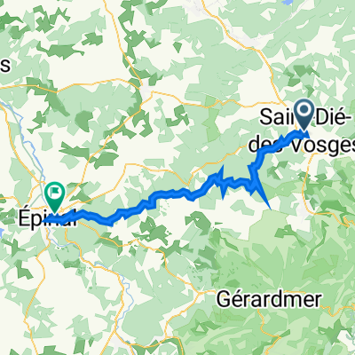
2012 French Tour -- Ride Day 21 -- 29 August 2012 -- St-Dié-des-Vosges to Sélestat- Distance
- 59.5 km
- Ascent
- 435 m
- Descent
- 599 m
- Location
- Saint-Dié, Grand Est, France
Saint Dié ex J05- Distance
- 71.7 km
- Ascent
- 919 m
- Descent
- 928 m
- Location
- Saint-Dié, Grand Est, France
Randonnée en Vosges et Alsace.- Distance
- 138.8 km
- Ascent
- 1,916 m
- Descent
- 1,907 m
- Location
- Saint-Dié, Grand Est, France
Open it in the app

