
AZALIA PONTYJSKA W KOŁACZNI
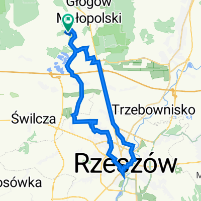
A cycling route starting in Głogów Małopolski, Subcarpathian Voivodeship, Poland.
Overview
About this route
GŁOGÓW MŁP PKP
OBÓZ NKWD W TRZEBUSCE
SOKOŁÓW MŁP
KOŁACZNIA
JEŻOWE
MAZIARNIA
STANY
GRĘBÓW
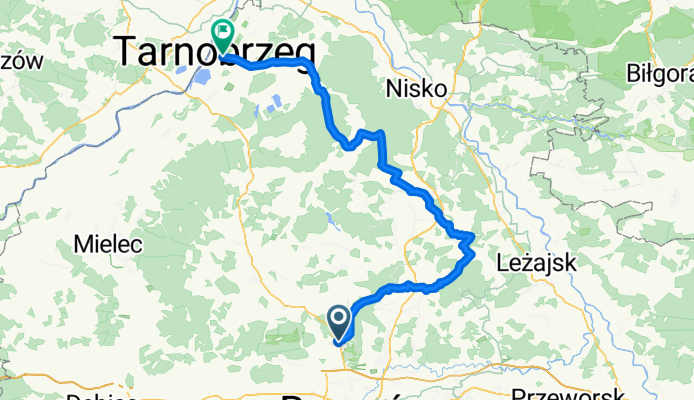
TARNOBRZEG
- -:--
- Duration
- 103.4 km
- Distance
- 147 m
- Ascent
- 215 m
- Descent
- ---
- Avg. speed
- ---
- Max. altitude

Route quality
Waytypes & surfaces along the route
Waytypes
Quiet road
38.3 km
(37 %)
Road
24.8 km
(24 %)
Surfaces
Paved
77.6 km
(75 %)
Unpaved
14.5 km
(14 %)
Asphalt
75.5 km
(73 %)
Gravel
7.2 km
(7 %)
Continue with Bikemap
Use, edit, or download this cycling route
You would like to ride AZALIA PONTYJSKA W KOŁACZNI or customize it for your own trip? Here is what you can do with this Bikemap route:
Free features
- Save this route as favorite or in collections
- Copy & plan your own version of this route
- Split it into stages to create a multi-day tour
- Sync your route with Garmin or Wahoo
Premium features
Free trial for 3 days, or one-time payment. More about Bikemap Premium.
- Navigate this route on iOS & Android
- Export a GPX / KML file of this route
- Create your custom printout (try it for free)
- Download this route for offline navigation
Discover more Premium features.
Get Bikemap PremiumFrom our community
Other popular routes starting in Głogów Małopolski
 bieg w borze
- Distance
- 30.9 km
- Ascent
- 134 m
- Descent
- 130 m
- Location
- Głogów Małopolski, Subcarpathian Voivodeship, Poland
 Zabajka- strefa Dworzysko- rynek Rzeszów- Zabajka
- Distance
- 35.6 km
- Ascent
- 114 m
- Descent
- 116 m
- Location
- Głogów Małopolski, Subcarpathian Voivodeship, Poland
 AZALIA PONTYJSKA W KOŁACZNI
- Distance
- 103.4 km
- Ascent
- 147 m
- Descent
- 215 m
- Location
- Głogów Małopolski, Subcarpathian Voivodeship, Poland
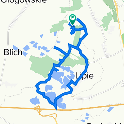 Tour de Lipie
- Distance
- 13.7 km
- Ascent
- 58 m
- Descent
- 55 m
- Location
- Głogów Małopolski, Subcarpathian Voivodeship, Poland
 Zabajka- lotnisko- Zapole- Zabajka
- Distance
- 31.3 km
- Ascent
- 122 m
- Descent
- 121 m
- Location
- Głogów Małopolski, Subcarpathian Voivodeship, Poland
 Pociągiem do Bud Głogowskich
- Distance
- 26.8 km
- Ascent
- 74 m
- Descent
- 116 m
- Location
- Głogów Małopolski, Subcarpathian Voivodeship, Poland
 Galicja Gravel Race 500 18.07
- Distance
- 502.7 km
- Ascent
- 1,608 m
- Descent
- 1,604 m
- Location
- Głogów Małopolski, Subcarpathian Voivodeship, Poland
 Teoretyczna trasa Łemko
- Distance
- 405 km
- Ascent
- 5,005 m
- Descent
- 4,995 m
- Location
- Głogów Małopolski, Subcarpathian Voivodeship, Poland
Open it in the app