

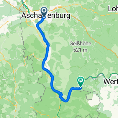
St 004: Aschaffenburg - Mosbach
A cycling route starting in Aschaffenburg, Bavaria, Germany.
Overview
About this route
ASCHAFFENBURG-Nilkheim - MAIN - Niedernberg - MAIN - Großwallstadt - MAIN - Obernburg - MAIN - WÖRTH - MAIN - KLINGENBERG - MAIN - Laudenbach - MAIN - Kleinheubach - MAIN - Gewerbegebiet MILTENBERG-West - Main-Neckar-Radweg (MN) - Breitendiel - MN - Weilbach - MN - AMORBACH - MN - Buch - MN - Ünglert - MN - MUDAU - MN/Wanderbahn - Langenelz - MN/ Wanderbahn - Laudenberg - MN/Wanderbahn - Limbach - MN/Wanderbahn - Krumbach - MN/ Wanderbahn - Fahrenbach - MN/Wanderbahn - Lohrbach - MN/Wanderbahn - Amorbach - MN - NECKARELZ - Neckarbrücke - Obrigheim - Schloß Neuburg
- -:--
- Duration
- 96.8 km
- Distance
- 540 m
- Ascent
- 438 m
- Descent
- ---
- Avg. speed
- ---
- Max. altitude
Route quality
Waytypes & surfaces along the route
Waytypes
Track
39.7 km
(41 %)
Quiet road
22.3 km
(23 %)
Surfaces
Paved
82.3 km
(85 %)
Unpaved
7.7 km
(8 %)
Asphalt
81.3 km
(84 %)
Loose gravel
5.8 km
(6 %)
Route highlights
Points of interest along the route
Point of interest after 25 km
Orientierungssuche am Bahnhof
Point of interest after 28.6 km
Rast im Park am Main
Point of interest after 53.2 km
Kurzrast im Wald
Point of interest after 59.1 km
Pause vor dem "Radler-Café)
Point of interest after 87.5 km
Schnell noch 'ne Karte für Kalle's Geburtstag geschrieben!
Point of interest after 87.6 km
Eiscafé-Rast
Accommodation after 96.8 km
Hotel Schloß Neuburg
Continue with Bikemap
Use, edit, or download this cycling route
You would like to ride St 004: Aschaffenburg - Mosbach or customize it for your own trip? Here is what you can do with this Bikemap route:
Free features
- Save this route as favorite or in collections
- Copy & plan your own version of this route
- Split it into stages to create a multi-day tour
- Sync your route with Garmin or Wahoo
Premium features
Free trial for 3 days, or one-time payment. More about Bikemap Premium.
- Navigate this route on iOS & Android
- Export a GPX / KML file of this route
- Create your custom printout (try it for free)
- Download this route for offline navigation
Discover more Premium features.
Get Bikemap PremiumFrom our community
Other popular routes starting in Aschaffenburg
 Von Aschaffenburg bis Frankfurt am Main
- Distance
- 53.3 km
- Ascent
- 152 m
- Descent
- 181 m
- Location
- Aschaffenburg, Bavaria, Germany
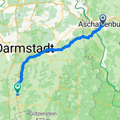
 Spessart - Aschaffenburg
- Distance
- 71.7 km
- Ascent
- 638 m
- Descent
- 643 m
- Location
- Aschaffenburg, Bavaria, Germany
 Von Aschaffenburg bis Freudenberg
- Distance
- 51 km
- Ascent
- 340 m
- Descent
- 327 m
- Location
- Aschaffenburg, Bavaria, Germany
 Aschaffenburg - Bensheim
- Distance
- 66.8 km
- Ascent
- 446 m
- Descent
- 481 m
- Location
- Aschaffenburg, Bavaria, Germany
 14.07.16 Aschaffenburg-Karlstein
- Distance
- 14.7 km
- Ascent
- 16 m
- Descent
- 34 m
- Location
- Aschaffenburg, Bavaria, Germany
 Kastanienweg nach Kastanienweg
- Distance
- 54.3 km
- Ascent
- 798 m
- Descent
- 851 m
- Location
- Aschaffenburg, Bavaria, Germany
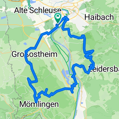
 Stallions Runde
- Distance
- 29.2 km
- Ascent
- 441 m
- Descent
- 440 m
- Location
- Aschaffenburg, Bavaria, Germany
 27.Januar 2019
- Distance
- 18.5 km
- Ascent
- 63 m
- Descent
- 45 m
- Location
- Aschaffenburg, Bavaria, Germany
Open it in the app