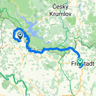
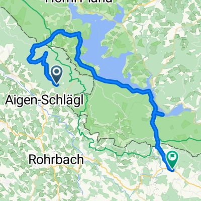
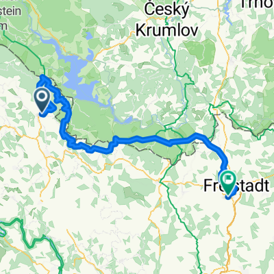
RCR: Frühjahrstour 18 II MTB
A cycling route starting in Aigen im Mühlkreis, Upper Austria, Austria.
Overview
About this route
Bahntrassenweg und Schwarzenberg'scher Schwemmkanal per MTB
- -:--
- Duration
- 115.5 km
- Distance
- 892 m
- Ascent
- 1,404 m
- Descent
- ---
- Avg. speed
- ---
- Avg. speed
Route quality
Waytypes & surfaces along the route
Waytypes
Road
40.2 km
(35 %)
Quiet road
28.3 km
(24 %)
Surfaces
Paved
54.2 km
(47 %)
Unpaved
5.7 km
(5 %)
Asphalt
51.9 km
(45 %)
Loose gravel
4.7 km
(4 %)
Continue with Bikemap
Use, edit, or download this cycling route
You would like to ride RCR: Frühjahrstour 18 II MTB or customize it for your own trip? Here is what you can do with this Bikemap route:
Free features
- Save this route as favorite or in collections
- Copy & plan your own version of this route
- Sync your route with Garmin or Wahoo
Premium features
Free trial for 3 days, or one-time payment. More about Bikemap Premium.
- Navigate this route on iOS & Android
- Export a GPX / KML file of this route
- Create your custom printout (try it for free)
- Download this route for offline navigation
Discover more Premium features.
Get Bikemap PremiumFrom our community
Other popular routes starting in Aigen im Mühlkreis
- 802 Sonnenwald
- Distance
- 24.2 km
- Ascent
- 330 m
- Descent
- 331 m
- Location
- Aigen im Mühlkreis, Upper Austria, Austria
- Böhmerwald -Tour
- Distance
- 69.5 km
- Ascent
- 532 m
- Descent
- 531 m
- Location
- Aigen im Mühlkreis, Upper Austria, Austria
- Aigen Schlägel - Lipno - Linz
- Distance
- 144.3 km
- Ascent
- 781 m
- Descent
- 1,078 m
- Location
- Aigen im Mühlkreis, Upper Austria, Austria
- Gründwaldrunde ca. 8,5km, 300Hm
- Distance
- 8.8 km
- Ascent
- 338 m
- Descent
- 336 m
- Location
- Aigen im Mühlkreis, Upper Austria, Austria
- Aigen - Kirchbach - St. Wolfgang - Aigen
- Distance
- 15.7 km
- Ascent
- 427 m
- Descent
- 430 m
- Location
- Aigen im Mühlkreis, Upper Austria, Austria
- Aigen - Plöckenstein - Aigen
- Distance
- 51.3 km
- Ascent
- 1,001 m
- Descent
- 1,001 m
- Location
- Aigen im Mühlkreis, Upper Austria, Austria
- Mühltalradweg
- Distance
- 28.9 km
- Ascent
- 241 m
- Descent
- 518 m
- Location
- Aigen im Mühlkreis, Upper Austria, Austria
- Mühlviertel bis Linz
- Distance
- 74.2 km
- Ascent
- 1,188 m
- Descent
- 1,161 m
- Location
- Aigen im Mühlkreis, Upper Austria, Austria
Open it in the app