

BRM 300 Teil 3 (320)
A cycling route starting in Messkirch, Baden-Wurttemberg, Germany.
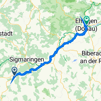
Overview
About this route
Source: www.audax-suisse.ch
Many people are not familiar with the Hegau and its wonderful volcanic landscapes, its impressive medieval castles, and the bizarre border lines with Switzerland. The BRM 300 takes you on low-traffic secondary roads through this fascinating and hilly region, and also includes a detour through the Zurich wine country, past the Rhine Falls, through the Klettgau, to the idyllic Danube valley, past the island of Mainau, and up onto the (Boden) Seerücken ridge. With the legendary climbs of Bluberger 'Sauhund' and the Muur de Tuttlingen, there are also some tough free souvenirs for the legs.
- -:--
- Duration
- 101.4 km
- Distance
- 619 m
- Ascent
- 809 m
- Descent
- ---
- Avg. speed
- ---
- Max. altitude

Route quality
Waytypes & surfaces along the route
Waytypes
Road
25.3 km
(25 %)
Quiet road
24.3 km
(24 %)
Surfaces
Paved
89.2 km
(88 %)
Unpaved
7.1 km
(7 %)
Asphalt
88.2 km
(87 %)
Gravel
7.1 km
(7 %)
Continue with Bikemap
Use, edit, or download this cycling route
You would like to ride BRM 300 Teil 3 (320) or customize it for your own trip? Here is what you can do with this Bikemap route:
Free features
- Save this route as favorite or in collections
- Copy & plan your own version of this route
- Split it into stages to create a multi-day tour
- Sync your route with Garmin or Wahoo
Premium features
Free trial for 3 days, or one-time payment. More about Bikemap Premium.
- Navigate this route on iOS & Android
- Export a GPX / KML file of this route
- Create your custom printout (try it for free)
- Download this route for offline navigation
Discover more Premium features.
Get Bikemap PremiumFrom our community
Other popular routes starting in Messkirch
 Kapfweg 2, Meßkirch nach Kapfweg 2, Meßkirch
- Distance
- 34.5 km
- Ascent
- 374 m
- Descent
- 378 m
- Location
- Messkirch, Baden-Wurttemberg, Germany
 Meßkirch- Höllsteige, Rennrad
- Distance
- 60.3 km
- Ascent
- 524 m
- Descent
- 524 m
- Location
- Messkirch, Baden-Wurttemberg, Germany
 Meßkirch-Donau-Ablach-Meßkirch
- Distance
- 50 km
- Ascent
- 183 m
- Descent
- 184 m
- Location
- Messkirch, Baden-Wurttemberg, Germany
 Hauptstraße 15, Meßkirch to Lindenstraße 28, Ehingen
- Distance
- 75.8 km
- Ascent
- 1,929 m
- Descent
- 2,018 m
- Location
- Messkirch, Baden-Wurttemberg, Germany
 Brucköschweg 2, Meßkirch nach Gutenbühlstraße 12, Leibertingen
- Distance
- 9.7 km
- Ascent
- 140 m
- Descent
- 71 m
- Location
- Messkirch, Baden-Wurttemberg, Germany
 Meßkirch nach Überlingen
- Distance
- 40.4 km
- Ascent
- 343 m
- Descent
- 562 m
- Location
- Messkirch, Baden-Wurttemberg, Germany
 Moderate Route in Meßkirch
- Distance
- 15.6 km
- Ascent
- 136 m
- Descent
- 137 m
- Location
- Messkirch, Baden-Wurttemberg, Germany
 MESSKIRCH - Beuron - Neuhausen - Retour
- Distance
- 62.7 km
- Ascent
- 836 m
- Descent
- 836 m
- Location
- Messkirch, Baden-Wurttemberg, Germany
Open it in the app