

W widłach Sanu
A cycling route starting in Gmina Modliborzyce, Lublin Voivodeship, Poland.
Overview
About this route
- -:--
- Duration
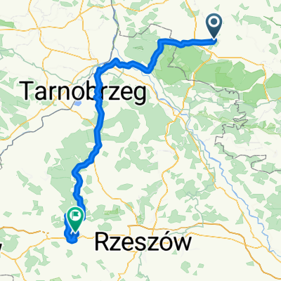
- 156.6 km
- Distance
- 215 m
- Ascent
- 263 m
- Descent
- ---
- Avg. speed
- ---
- Max. altitude

Route quality
Waytypes & surfaces along the route
Waytypes
Road
72 km
(46 %)
Quiet road
17.2 km
(11 %)
Surfaces
Paved
136.3 km
(87 %)
Unpaved
1.6 km
(1 %)
Asphalt
134.7 km
(86 %)
Paved (undefined)
1.6 km
(1 %)
Continue with Bikemap
Use, edit, or download this cycling route
You would like to ride W widłach Sanu or customize it for your own trip? Here is what you can do with this Bikemap route:
Free features
- Save this route as favorite or in collections
- Copy & plan your own version of this route
- Split it into stages to create a multi-day tour
- Sync your route with Garmin or Wahoo
Premium features
Free trial for 3 days, or one-time payment. More about Bikemap Premium.
- Navigate this route on iOS & Android
- Export a GPX / KML file of this route
- Create your custom printout (try it for free)
- Download this route for offline navigation
Discover more Premium features.
Get Bikemap PremiumFrom our community
Other popular routes starting in Gmina Modliborzyce
 bcv xcvcxv
- Distance
- 10.8 km
- Ascent
- 107 m
- Descent
- 63 m
- Location
- Gmina Modliborzyce, Lublin Voivodeship, Poland
 Recovered Route
- Distance
- 29 km
- Ascent
- 300 m
- Descent
- 283 m
- Location
- Gmina Modliborzyce, Lublin Voivodeship, Poland
 imielty lug Stalowa Wola
- Distance
- 22.5 km
- Ascent
- 0 m
- Descent
- 4 m
- Location
- Gmina Modliborzyce, Lublin Voivodeship, Poland
 W widłach Sanu
- Distance
- 156.6 km
- Ascent
- 215 m
- Descent
- 263 m
- Location
- Gmina Modliborzyce, Lublin Voivodeship, Poland
 Modliborzyce - Piłatka - Zdziłowice - Godziszów - Biała - M-ce
- Distance
- 44 km
- Ascent
- 297 m
- Descent
- 297 m
- Location
- Gmina Modliborzyce, Lublin Voivodeship, Poland
 Unnamed Road to Janowska 34, Goraj
- Distance
- 36.1 km
- Ascent
- 306 m
- Descent
- 266 m
- Location
- Gmina Modliborzyce, Lublin Voivodeship, Poland
 Modliborzyce_przez_las
- Distance
- 34.3 km
- Ascent
- 113 m
- Descent
- 113 m
- Location
- Gmina Modliborzyce, Lublin Voivodeship, Poland
 bbbbbbbb
- Distance
- 0.8 km
- Ascent
- 32 m
- Descent
- 0 m
- Location
- Gmina Modliborzyce, Lublin Voivodeship, Poland
Open it in the app