
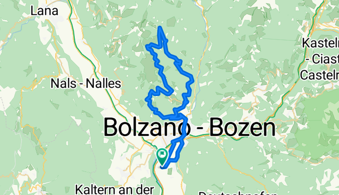
T2 Jensienrunde
A cycling route starting in San Giacomo, Trentino-Alto Adige, Italy.
Overview
About this route
- -:--
- Duration
- 58.4 km
- Distance
- 1,404 m
- Ascent
- 1,401 m
- Descent
- ---
- Avg. speed
- ---
- Max. altitude

Continue with Bikemap
Use, edit, or download this cycling route
You would like to ride T2 Jensienrunde or customize it for your own trip? Here is what you can do with this Bikemap route:
Free features
- Save this route as favorite or in collections
- Copy & plan your own version of this route
- Sync your route with Garmin or Wahoo
Premium features
Free trial for 3 days, or one-time payment. More about Bikemap Premium.
- Navigate this route on iOS & Android
- Export a GPX / KML file of this route
- Create your custom printout (try it for free)
- Download this route for offline navigation
Discover more Premium features.
Get Bikemap PremiumFrom our community
Other popular routes starting in San Giacomo
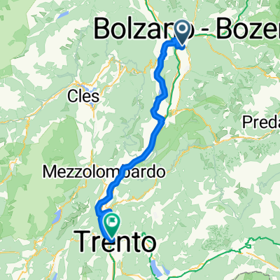
 Route zu Lainez Rooms & Suites
- Distance
- 62.9 km
- Ascent
- 189 m
- Descent
- 232 m
- Location
- San Giacomo, Trentino-Alto Adige, Italy
 Bolzano dream
- Distance
- 323.2 km
- Ascent
- 6,180 m
- Descent
- 6,176 m
- Location
- San Giacomo, Trentino-Alto Adige, Italy
 Giro delle Dolomiti 1.Etappe
- Distance
- 50.7 km
- Ascent
- 1,190 m
- Descent
- 1,188 m
- Location
- San Giacomo, Trentino-Alto Adige, Italy
 1Tag 2018 Bozen Trient
- Distance
- 65.5 km
- Ascent
- 43 m
- Descent
- 92 m
- Location
- San Giacomo, Trentino-Alto Adige, Italy
 T2 Jensienrunde
- Distance
- 58.4 km
- Ascent
- 1,404 m
- Descent
- 1,401 m
- Location
- San Giacomo, Trentino-Alto Adige, Italy
 Bozen-KaltererSee-Tramin-Trient
- Distance
- 69 km
- Ascent
- 499 m
- Descent
- 549 m
- Location
- San Giacomo, Trentino-Alto Adige, Italy
 hotel raffl- montiggl
- Distance
- 20.4 km
- Ascent
- 338 m
- Descent
- 99 m
- Location
- San Giacomo, Trentino-Alto Adige, Italy
 Italy - Day 3
- Distance
- 63 km
- Ascent
- 191 m
- Descent
- 233 m
- Location
- San Giacomo, Trentino-Alto Adige, Italy
Open it in the app