

Overview
About this route
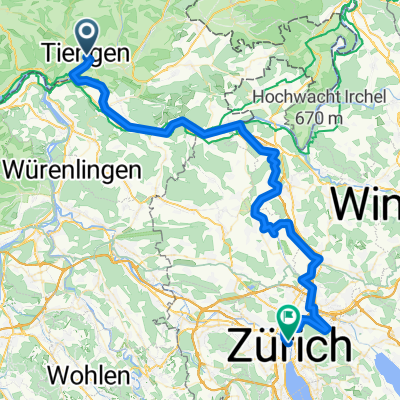
through the Mandach valley to Rotberg, over the Aare into the Reuss valley, back over the Limmat through the Aare valley
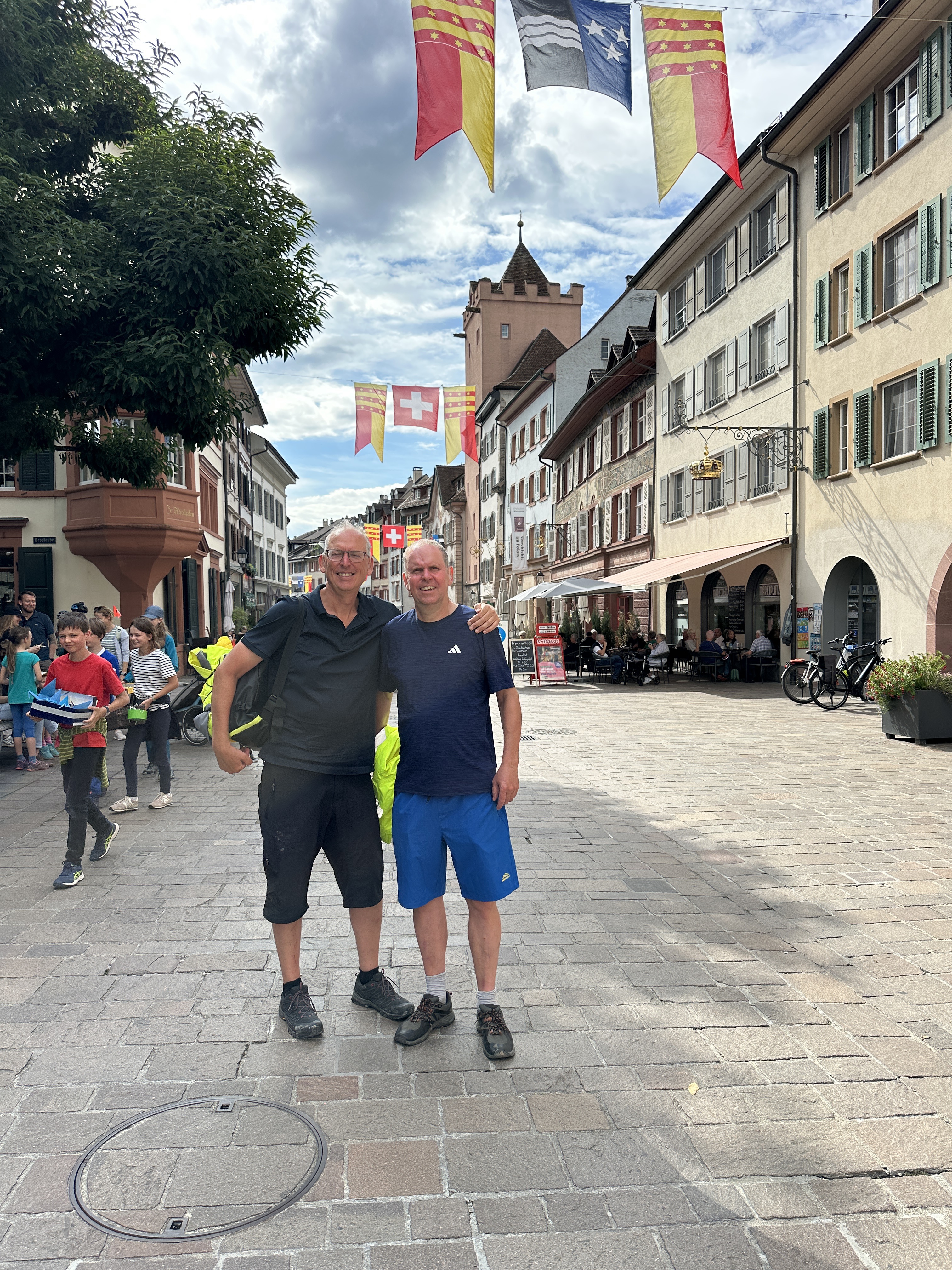
with Gerhard A, Günter, Peter, Reiner G
- -:--
- Duration
- 67.3 km
- Distance
- 449 m
- Ascent
- 471 m
- Descent
- ---
- Avg. speed
- ---
- Max. altitude

Part of
Prologe
12 stages
Route quality
Waytypes & surfaces along the route
Waytypes
Road
16.2 km
(24 %)
Quiet road
14.8 km
(22 %)
Surfaces
Paved
51.1 km
(76 %)
Unpaved
1.3 km
(2 %)
Asphalt
45.1 km
(67 %)
Paved (undefined)
6.1 km
(9 %)
Continue with Bikemap
Use, edit, or download this cycling route
You would like to ride 24. Prolog 2018 or customize it for your own trip? Here is what you can do with this Bikemap route:
Free features
- Save this route as favorite or in collections
- Copy & plan your own version of this route
- Sync your route with Garmin or Wahoo
Premium features
Free trial for 3 days, or one-time payment. More about Bikemap Premium.
- Navigate this route on iOS & Android
- Export a GPX / KML file of this route
- Create your custom printout (try it for free)
- Download this route for offline navigation
Discover more Premium features.
Get Bikemap PremiumFrom our community
Other popular routes starting in Lauchringen
 Äulemer Kreuz - Lauchringen -Rundfahrt
- Distance
- 99.9 km
- Ascent
- 1,567 m
- Descent
- 1,497 m
- Location
- Lauchringen, Baden-Wurttemberg, Germany
 076b BIKETOUR - Herrmann Waldshut Zürich Final
- Distance
- 69.7 km
- Ascent
- 531 m
- Descent
- 459 m
- Location
- Lauchringen, Baden-Wurttemberg, Germany
 Schaffhauser Straße, Waldshut-Tiengen to Schönbeinstrasse, Basel
- Distance
- 79 km
- Ascent
- 458 m
- Descent
- 525 m
- Location
- Lauchringen, Baden-Wurttemberg, Germany
 Entspannte Route
- Distance
- 31.6 km
- Ascent
- 113 m
- Descent
- 117 m
- Location
- Lauchringen, Baden-Wurttemberg, Germany
 Tiengen-Feldberg und zurück
- Distance
- 93.1 km
- Ascent
- 1,230 m
- Descent
- 1,234 m
- Location
- Lauchringen, Baden-Wurttemberg, Germany
 Hochrhein Fluss aufwärts. zurück durch die Schweiz
- Distance
- 25.8 km
- Ascent
- 54 m
- Descent
- 57 m
- Location
- Lauchringen, Baden-Wurttemberg, Germany
 Die Wutach entlang ins Klettgautal
- Distance
- 46.6 km
- Ascent
- 286 m
- Descent
- 258 m
- Location
- Lauchringen, Baden-Wurttemberg, Germany
 Abendrunde rund um Tiengen
- Distance
- 25.6 km
- Ascent
- 650 m
- Descent
- 650 m
- Location
- Lauchringen, Baden-Wurttemberg, Germany
Open it in the app