

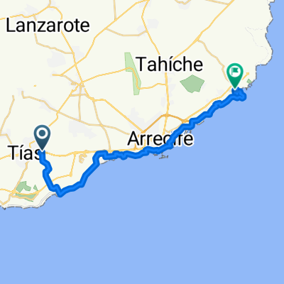
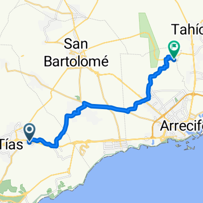
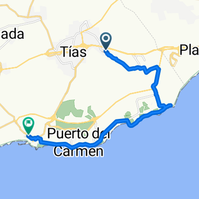
Verkürzte Variante der Ironmanstrecke
A cycling route starting in Tías, Canary Islands, Spain.
Overview
About this route
Ironman route without El Golfo, National Park and 'Nazareth'
- -:--
- Duration
- 133.4 km
- Distance
- 1,738 m
- Ascent
- 1,576 m
- Descent
- ---
- Avg. speed
- 586 m
- Max. altitude
Route quality
Waytypes & surfaces along the route
Waytypes
Track
22.7 km
(17 %)
Road
10.7 km
(8 %)
Surfaces
Paved
92.1 km
(69 %)
Unpaved
24 km
(18 %)
Asphalt
92.1 km
(69 %)
Gravel
9.3 km
(7 %)
Continue with Bikemap
Use, edit, or download this cycling route
You would like to ride Verkürzte Variante der Ironmanstrecke or customize it for your own trip? Here is what you can do with this Bikemap route:
Free features
- Save this route as favorite or in collections
- Copy & plan your own version of this route
- Split it into stages to create a multi-day tour
- Sync your route with Garmin or Wahoo
Premium features
Free trial for 3 days, or one-time payment. More about Bikemap Premium.
- Navigate this route on iOS & Android
- Export a GPX / KML file of this route
- Create your custom printout (try it for free)
- Download this route for offline navigation
Discover more Premium features.
Get Bikemap PremiumFrom our community
Other popular routes starting in Tías
 Lanzarote - 87 km - 870 hm - Süden
- Distance
- 86.8 km
- Ascent
- 830 m
- Descent
- 833 m
- Location
- Tías, Canary Islands, Spain
 Camino Lugar de Abajo to Avenida de las Islas Canarias
- Distance
- 29.1 km
- Ascent
- 156 m
- Descent
- 305 m
- Location
- Tías, Canary Islands, Spain
 Die Playa Blanca, Nationalpark, Nazareth, Areciffe und zurück Tour
- Distance
- 104.4 km
- Ascent
- 860 m
- Descent
- 862 m
- Location
- Tías, Canary Islands, Spain
 Camino Lugar de Abajo to LZ-2
- Distance
- 35.4 km
- Ascent
- 441 m
- Descent
- 486 m
- Location
- Tías, Canary Islands, Spain
 Lanzarote - 80km - 900 hm - La Santa
- Distance
- 81.2 km
- Ascent
- 839 m
- Descent
- 839 m
- Location
- Tías, Canary Islands, Spain
 Camino Lugar de Abajo to Lugar Diseminado Tahiche
- Distance
- 14 km
- Ascent
- 198 m
- Descent
- 254 m
- Location
- Tías, Canary Islands, Spain
 Die Puerto del Carmen, Orozola, Je, Haria, Tabayesco, Teseguite, Teguise,Conil, Puerto del Carmen Runde
- Distance
- 129 km
- Ascent
- 1,293 m
- Descent
- 1,124 m
- Location
- Tías, Canary Islands, Spain
 Monday morning loop
- Distance
- 12.6 km
- Ascent
- 88 m
- Descent
- 181 m
- Location
- Tías, Canary Islands, Spain
Open it in the app