

Berg- und Talfahrt
A cycling route starting in Crottendorf, Saxony, Germany.
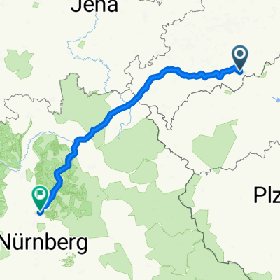
Overview
About this route
Challenging mountain and valley loop starting and finishing at the Neudorf sports field. Mostly good, firm paths.
- -:--
- Duration
- 32.4 km
- Distance
- 666 m
- Ascent
- 666 m
- Descent
- ---
- Avg. speed
- ---
- Max. altitude

Route photos

Continue with Bikemap
Use, edit, or download this cycling route
You would like to ride Berg- und Talfahrt or customize it for your own trip? Here is what you can do with this Bikemap route:
Free features
- Save this route as favorite or in collections
- Copy & plan your own version of this route
- Sync your route with Garmin or Wahoo
Premium features
Free trial for 3 days, or one-time payment. More about Bikemap Premium.
- Navigate this route on iOS & Android
- Export a GPX / KML file of this route
- Create your custom printout (try it for free)
- Download this route for offline navigation
Discover more Premium features.
Get Bikemap PremiumFrom our community
Other popular routes starting in Crottendorf
 ANA => EH
- Distance
- 227.3 km
- Ascent
- 1,476 m
- Descent
- 1,797 m
- Location
- Crottendorf, Saxony, Germany
 Rote Grube
- Distance
- 50.6 km
- Ascent
- 924 m
- Descent
- 920 m
- Location
- Crottendorf, Saxony, Germany
 Neuendorf-Fichtelberg-Bärenstein-Neuendorf
- Distance
- 47.8 km
- Ascent
- 1,062 m
- Descent
- 1,062 m
- Location
- Crottendorf, Saxony, Germany
 Neudorf - Bergschmiede Frohnau - Zschopautal - Neudorf
- Distance
- 39.2 km
- Ascent
- 573 m
- Descent
- 574 m
- Location
- Crottendorf, Saxony, Germany
 Neudorf-Fichtelberg-Keilberg-Wolfener Mühle
- Distance
- 40.4 km
- Ascent
- 909 m
- Descent
- 902 m
- Location
- Crottendorf, Saxony, Germany
 Kleine Grenzrunde 2, Neudorf - Kovarska - Bärenstein - Neudorf
- Distance
- 33.6 km
- Ascent
- 442 m
- Descent
- 440 m
- Location
- Crottendorf, Saxony, Germany
 Cranzahl-Zschopautal-Chemnitz
- Distance
- 69.9 km
- Ascent
- 365 m
- Descent
- 656 m
- Location
- Crottendorf, Saxony, Germany
 Kleine Grenzrunde, Neudorf-Kovarska-Haj-Oberwiesenthal-Neudorf
- Distance
- 36.6 km
- Ascent
- 590 m
- Descent
- 590 m
- Location
- Crottendorf, Saxony, Germany
Open it in the app