

90km Ehingen - Vaihingen
A cycling route starting in Mehrstetten, Baden-Wurttemberg, Germany.
Overview
About this route
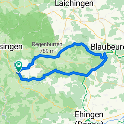
From Ehingen to Vaihingen, leaving Bad Urach on the right
- -:--
- Duration
- 90.2 km
- Distance
- 613 m
- Ascent
- 872 m
- Descent
- ---
- Avg. speed
- ---
- Max. altitude

Route quality
Waytypes & surfaces along the route
Waytypes
Road
17.1 km
(19 %)
Track
17.1 km
(19 %)
Surfaces
Paved
83 km
(92 %)
Unpaved
0.9 km
(1 %)
Asphalt
81.1 km
(90 %)
Paved (undefined)
1.8 km
(2 %)
Continue with Bikemap
Use, edit, or download this cycling route
You would like to ride 90km Ehingen - Vaihingen or customize it for your own trip? Here is what you can do with this Bikemap route:
Free features
- Save this route as favorite or in collections
- Copy & plan your own version of this route
- Split it into stages to create a multi-day tour
- Sync your route with Garmin or Wahoo
Premium features
Free trial for 3 days, or one-time payment. More about Bikemap Premium.
- Navigate this route on iOS & Android
- Export a GPX / KML file of this route
- Create your custom printout (try it for free)
- Download this route for offline navigation
Discover more Premium features.
Get Bikemap PremiumFrom our community
Other popular routes starting in Mehrstetten
 Ski 29.05.2016
- Distance
- 47.7 km
- Ascent
- 423 m
- Descent
- 422 m
- Location
- Mehrstetten, Baden-Wurttemberg, Germany
 Meine Gegend
- Distance
- 118.2 km
- Ascent
- 1,260 m
- Descent
- 1,232 m
- Location
- Mehrstetten, Baden-Wurttemberg, Germany
 90km Ehingen - Vaihingen
- Distance
- 90.2 km
- Ascent
- 613 m
- Descent
- 872 m
- Location
- Mehrstetten, Baden-Wurttemberg, Germany
 Burg Teck
- Distance
- 69.5 km
- Ascent
- 1,801 m
- Descent
- 1,765 m
- Location
- Mehrstetten, Baden-Wurttemberg, Germany
 Sonntagstour 150802
- Distance
- 39.8 km
- Ascent
- 366 m
- Descent
- 372 m
- Location
- Mehrstetten, Baden-Wurttemberg, Germany
 Hundersingen- Kloster Marchtal-Schloss Mochental-Bremelau und zurück
- Distance
- 50.3 km
- Ascent
- 960 m
- Descent
- 959 m
- Location
- Mehrstetten, Baden-Wurttemberg, Germany
 Wanderung im Großen Lautertal
- Distance
- 15.5 km
- Ascent
- 324 m
- Descent
- 324 m
- Location
- Mehrstetten, Baden-Wurttemberg, Germany
 S>L T2 Hotel-Landgasthof Krone
- Distance
- 72.2 km
- Ascent
- 550 m
- Descent
- 597 m
- Location
- Mehrstetten, Baden-Wurttemberg, Germany
Open it in the app