

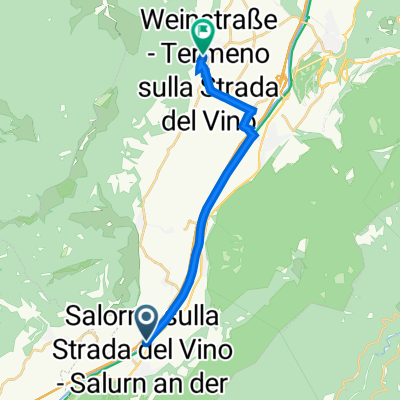
G9 Salurn - Bozen
A cycling route starting in Salorno, Trentino-Alto Adige, Italy.
Overview
About this route
- -:--
- Duration
- 34 km
- Distance
- 68 m
- Ascent
- 33 m
- Descent
- ---
- Avg. speed
- ---
- Max. altitude

Route quality
Waytypes & surfaces along the route
Waytypes
Cycleway
33 km
(97 %)
Quiet road
0.3 km
(1 %)
Surfaces
Paved
33.4 km
(98 %)
Asphalt
33.4 km
(98 %)
Undefined
0.7 km
(2 %)
Continue with Bikemap
Use, edit, or download this cycling route
You would like to ride G9 Salurn - Bozen or customize it for your own trip? Here is what you can do with this Bikemap route:
Free features
- Save this route as favorite or in collections
- Copy & plan your own version of this route
- Sync your route with Garmin or Wahoo
Premium features
Free trial for 3 days, or one-time payment. More about Bikemap Premium.
- Navigate this route on iOS & Android
- Export a GPX / KML file of this route
- Create your custom printout (try it for free)
- Download this route for offline navigation
Discover more Premium features.
Get Bikemap PremiumFrom our community
Other popular routes starting in Salorno
 Alpen 22 3. Tag
- Distance
- 90.1 km
- Ascent
- 1,736 m
- Descent
- 1,855 m
- Location
- Salorno, Trentino-Alto Adige, Italy
 2014 - 7. Tag Salurn - Rovereto
- Distance
- 57.8 km
- Ascent
- 56 m
- Descent
- 87 m
- Location
- Salorno, Trentino-Alto Adige, Italy
 Salurn nach Rathausplatz 7, Tramin an der Weinstraße
- Distance
- 13.3 km
- Ascent
- 159 m
- Descent
- 84 m
- Location
- Salorno, Trentino-Alto Adige, Italy
 2003 T6 Salurn - Malcesine
- Distance
- 83.4 km
- Ascent
- 301 m
- Descent
- 447 m
- Location
- Salorno, Trentino-Alto Adige, Italy
 G9 Salurn - Bozen
- Distance
- 34 km
- Ascent
- 68 m
- Descent
- 33 m
- Location
- Salorno, Trentino-Alto Adige, Italy
 Day I4
- Distance
- 44.5 km
- Ascent
- 153 m
- Descent
- 182 m
- Location
- Salorno, Trentino-Alto Adige, Italy
 Salurn - Ala Picante
- Distance
- 73.1 km
- Ascent
- 317 m
- Descent
- 380 m
- Location
- Salorno, Trentino-Alto Adige, Italy
 ita100.001.a06 6. Etappe Salurn - Trento
- Distance
- 32.6 km
- Ascent
- 120 m
- Descent
- 135 m
- Location
- Salorno, Trentino-Alto Adige, Italy
Open it in the app