

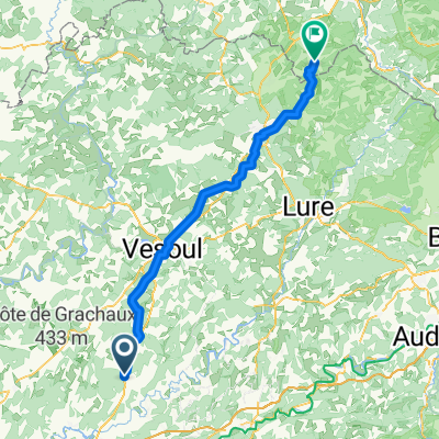
Jakobsweg 5 (Couthenans - Gy)
A cycling route starting in Rioz, Bourgogne-Franche-Comté, France.
Overview
About this route
- -:--
- Duration
- 103.4 km
- Distance
- 982 m
- Ascent
- 868 m
- Descent
- ---
- Avg. speed
- ---
- Max. altitude
Route quality
Waytypes & surfaces along the route
Waytypes
Track
48.6 km
(47 %)
Quiet road
27.9 km
(27 %)
Surfaces
Paved
13.4 km
(13 %)
Unpaved
19.6 km
(19 %)
Asphalt
12.4 km
(12 %)
Unpaved (undefined)
10.3 km
(10 %)
Continue with Bikemap
Use, edit, or download this cycling route
You would like to ride Jakobsweg 5 (Couthenans - Gy) or customize it for your own trip? Here is what you can do with this Bikemap route:
Free features
- Save this route as favorite or in collections
- Copy & plan your own version of this route
- Split it into stages to create a multi-day tour
- Sync your route with Garmin or Wahoo
Premium features
Free trial for 3 days, or one-time payment. More about Bikemap Premium.
- Navigate this route on iOS & Android
- Export a GPX / KML file of this route
- Create your custom printout (try it for free)
- Download this route for offline navigation
Discover more Premium features.
Get Bikemap PremiumFrom our community
Other popular routes starting in Rioz
 07_Maizieres - Gy
- Distance
- 23.9 km
- Ascent
- 588 m
- Descent
- 602 m
- Location
- Rioz, Bourgogne-Franche-Comté, France
 Rue de l'Église, Rioz à Route de Moyemont, Le Val-d'Ajol
- Distance
- 81.6 km
- Ascent
- 1,165 m
- Descent
- 963 m
- Location
- Rioz, Bourgogne-Franche-Comté, France
 Chateau Roche - Montfaucon
- Distance
- 37.2 km
- Ascent
- 523 m
- Descent
- 260 m
- Location
- Rioz, Bourgogne-Franche-Comté, France
 Gray Marnay
- Distance
- 90.1 km
- Ascent
- 447 m
- Descent
- 441 m
- Location
- Rioz, Bourgogne-Franche-Comté, France
 Dag16_2018
- Distance
- 49.5 km
- Ascent
- 415 m
- Descent
- 418 m
- Location
- Rioz, Bourgogne-Franche-Comté, France
 Rigney - Montfaucon
- Distance
- 61.7 km
- Ascent
- 656 m
- Descent
- 656 m
- Location
- Rioz, Bourgogne-Franche-Comté, France
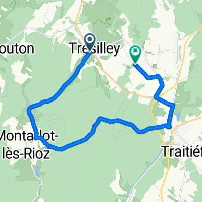 Rue de la Mairie, Trésilley à Chemin de la Roche, Rioz
- Distance
- 14.9 km
- Ascent
- 214 m
- Descent
- 208 m
- Location
- Rioz, Bourgogne-Franche-Comté, France
 petite sortie bosses
- Distance
- 56.5 km
- Ascent
- 849 m
- Descent
- 849 m
- Location
- Rioz, Bourgogne-Franche-Comté, France
Open it in the app