

Balades Sancéenne
A cycling route starting in Saint-Julien-les-Villas, Grand Est, France.
Overview
About this route
La journée forte du 109 km des balades Sancéenne
- -:--
- Duration
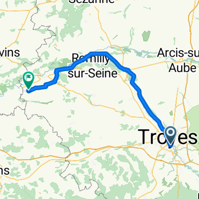
- 106.7 km
- Distance
- 430 m
- Ascent
- 432 m
- Descent
- ---
- Avg. speed
- ---
- Max. altitude

Route quality
Waytypes & surfaces along the route
Waytypes
Road
55 km
(52 %)
Busy road
43.1 km
(40 %)
Surfaces
Paved
14.7 km
(14 %)
Unpaved
1.3 km
(1 %)
Asphalt
14.4 km
(13 %)
Gravel
0.6 km
(<1 %)
Continue with Bikemap
Use, edit, or download this cycling route
You would like to ride Balades Sancéenne or customize it for your own trip? Here is what you can do with this Bikemap route:
Free features
- Save this route as favorite or in collections
- Copy & plan your own version of this route
- Split it into stages to create a multi-day tour
- Sync your route with Garmin or Wahoo
Premium features
Free trial for 3 days, or one-time payment. More about Bikemap Premium.
- Navigate this route on iOS & Android
- Export a GPX / KML file of this route
- Create your custom printout (try it for free)
- Download this route for offline navigation
Discover more Premium features.
Get Bikemap PremiumFrom our community
Other popular routes starting in Saint-Julien-les-Villas
 De Rue Aristide Briand 4, Saint-Julien-les-Villas à Rue Aristide Briand 11, Saint-Julien-les-Villas
- Distance
- 25.4 km
- Ascent
- 18 m
- Descent
- 10 m
- Location
- Saint-Julien-les-Villas, Grand Est, France
 Balades Sancéenne
- Distance
- 106.7 km
- Ascent
- 430 m
- Descent
- 432 m
- Location
- Saint-Julien-les-Villas, Grand Est, France
 De 130 Avenue Michel Baroin, Saint-Julien-les-Villas à D1g, Lusigny-sur-Barse
- Distance
- 21.6 km
- Ascent
- 62 m
- Descent
- 31 m
- Location
- Saint-Julien-les-Villas, Grand Est, France
 Saint-Jacques à vélo via Vézelay: Saint-Julien-les-Villas → Buchères
- Distance
- 8.8 km
- Ascent
- 44 m
- Descent
- 36 m
- Location
- Saint-Julien-les-Villas, Grand Est, France
 Tour de la Burie
- Distance
- 2.8 km
- Ascent
- 11 m
- Descent
- 10 m
- Location
- Saint-Julien-les-Villas, Grand Est, France
 Converted from a KML file using KML2GPX.COM - Track no: 1
- Distance
- 127.1 km
- Ascent
- 1,460 m
- Descent
- 1,399 m
- Location
- Saint-Julien-les-Villas, Grand Est, France
 6. Troyes - Gumery
- Distance
- 76 km
- Ascent
- 150 m
- Descent
- 188 m
- Location
- Saint-Julien-les-Villas, Grand Est, France
 La Chapelle-Saint-Luc - Bray-sur-Seine
- Distance
- 76 km
- Ascent
- 150 m
- Descent
- 188 m
- Location
- Saint-Julien-les-Villas, Grand Est, France
Open it in the app