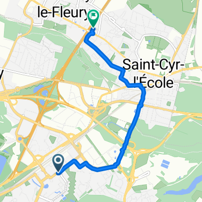
pn1
A cycling route starting in Montigny-le-Bretonneux, ÃŽle-de-France Region, France.
Overview
About this route
Montigny Le Bretonneux - Cosne-Cours-sur-Loire
- -:--
- Duration
- 218.3 km
- Distance
- 359 m
- Ascent
- 335 m
- Descent
- ---
- Avg. speed
- ---
- Avg. speed
Route quality
Waytypes & surfaces along the route
Waytypes
Quiet road
82.6 km
(38 %)
Busy road
59.4 km
(27 %)
Surfaces
Paved
114.9 km
(53 %)
Unpaved
13.4 km
(6 %)
Asphalt
108.7 km
(50 %)
Gravel
10 km
(5 %)
Continue with Bikemap
Use, edit, or download this cycling route
You would like to ride pn1 or customize it for your own trip? Here is what you can do with this Bikemap route:
Free features
- Save this route as favorite or in collections
- Copy & plan your own version of this route
- Sync your route with Garmin or Wahoo
Premium features
Free trial for 3 days, or one-time payment. More about Bikemap Premium.
- Navigate this route on iOS & Android
- Export a GPX / KML file of this route
- Create your custom printout (try it for free)
- Download this route for offline navigation
Discover more Premium features.
Get Bikemap PremiumFrom our community
Other popular routes starting in Montigny-le-Bretonneux
- Itinéraire modéré en Montigny-le-Bretonneux
- Distance
- 33.7 km
- Ascent
- 387 m
- Descent
- 410 m
- Location
- Montigny-le-Bretonneux, ÃŽle-de-France Region, France
- 20150419_101924.gpx
- Distance
- 73.9 km
- Ascent
- 394 m
- Descent
- 394 m
- Location
- Montigny-le-Bretonneux, ÃŽle-de-France Region, France
- confinement 2 + long
- Distance
- 18.2 km
- Ascent
- 40 m
- Descent
- 35 m
- Location
- Montigny-le-Bretonneux, ÃŽle-de-France Region, France
- Ze Vay to Vork
- Distance
- 26.5 km
- Ascent
- 143 m
- Descent
- 261 m
- Location
- Montigny-le-Bretonneux, ÃŽle-de-France Region, France
- De Boulevard Vauban à Görlitzer Straße
- Distance
- 1,265.1 km
- Ascent
- 5,625 m
- Descent
- 5,744 m
- Location
- Montigny-le-Bretonneux, ÃŽle-de-France Region, France
- Training_roulant
- Distance
- 58.8 km
- Ascent
- 314 m
- Descent
- 324 m
- Location
- Montigny-le-Bretonneux, ÃŽle-de-France Region, France
- pn1
- Distance
- 218.3 km
- Ascent
- 359 m
- Descent
- 335 m
- Location
- Montigny-le-Bretonneux, ÃŽle-de-France Region, France
- De 58 Avenue Joseph Kessel, Montigny-le-Bretonneux à Avenue de Kierpse, Montigny-le-Bretonneux
- Distance
- 20.1 km
- Ascent
- 200 m
- Descent
- 193 m
- Location
- Montigny-le-Bretonneux, ÃŽle-de-France Region, France
Open it in the app