

Vercors
A cycling route starting in Pont-en-Royans, Auvergne-Rhône-Alpes, France.
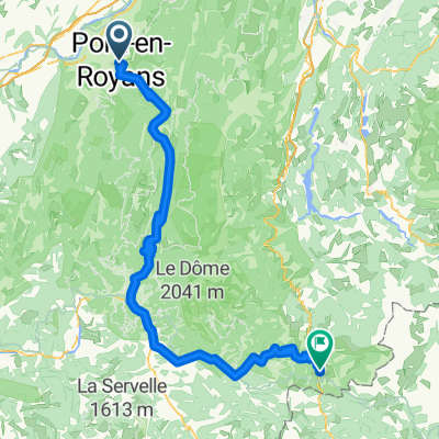
Overview
About this route
Jean en Royans Preles Cognin Saint Romans Pont en Royans
- -:--
- Duration
- 61.9 km
- Distance
- 1,339 m
- Ascent
- 1,323 m
- Descent
- ---
- Avg. speed
- ---
- Max. altitude
Route quality
Waytypes & surfaces along the route
Waytypes
Road
34.2 km
(55 %)
Busy road
18.9 km
(31 %)
Surfaces
Paved
27.9 km
(45 %)
Unpaved
0.6 km
(<1 %)
Asphalt
27.9 km
(45 %)
Ground
0.6 km
(<1 %)
Undefined
33.5 km
(54 %)
Continue with Bikemap
Use, edit, or download this cycling route
You would like to ride Vercors or customize it for your own trip? Here is what you can do with this Bikemap route:
Free features
- Save this route as favorite or in collections
- Copy & plan your own version of this route
- Sync your route with Garmin or Wahoo
Premium features
Free trial for 3 days, or one-time payment. More about Bikemap Premium.
- Navigate this route on iOS & Android
- Export a GPX / KML file of this route
- Create your custom printout (try it for free)
- Download this route for offline navigation
Discover more Premium features.
Get Bikemap PremiumFrom our community
Other popular routes starting in Pont-en-Royans
 Sud de Vercors
- Distance
- 123.8 km
- Ascent
- 2,596 m
- Descent
- 2,596 m
- Location
- Pont-en-Royans, Auvergne-Rhône-Alpes, France
 Vercors: Five Cols, Two Gorges
- Distance
- 76.9 km
- Ascent
- 2,194 m
- Descent
- 2,194 m
- Location
- Pont-en-Royans, Auvergne-Rhône-Alpes, France
 Vercors: Combe Laval
- Distance
- 56.6 km
- Ascent
- 1,186 m
- Descent
- 1,185 m
- Location
- Pont-en-Royans, Auvergne-Rhône-Alpes, France
 2016 Ride Day 152 - Pont-en-Royans to Valence
- Distance
- 67.2 km
- Ascent
- 984 m
- Descent
- 1,074 m
- Location
- Pont-en-Royans, Auvergne-Rhône-Alpes, France
 3 ème étape Summer Ride
- Distance
- 103.8 km
- Ascent
- 2,026 m
- Descent
- 1,219 m
- Location
- Pont-en-Royans, Auvergne-Rhône-Alpes, France
 Combe Laval- Col de la Bataille
- Distance
- 118.4 km
- Ascent
- 4,153 m
- Descent
- 4,154 m
- Location
- Pont-en-Royans, Auvergne-Rhône-Alpes, France
 quaeldich Route 3 50km
- Distance
- 23.5 km
- Ascent
- 1,703 m
- Descent
- 940 m
- Location
- Pont-en-Royans, Auvergne-Rhône-Alpes, France
 Gorges du Nan Combe Lavel
- Distance
- 61 km
- Ascent
- 2,606 m
- Descent
- 2,606 m
- Location
- Pont-en-Royans, Auvergne-Rhône-Alpes, France
Open it in the app