

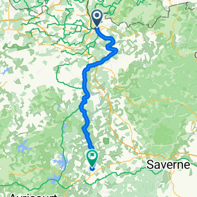
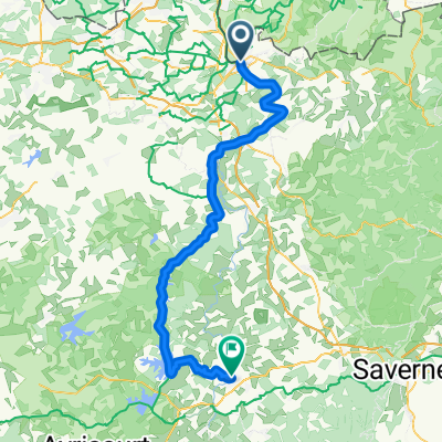
French Saar Region
A cycling route starting in Sarreguemines, Grand Est, France.
Overview
About this route
- -:--
- Duration
- 24.1 km
- Distance
- 49 m
- Ascent
- 40 m
- Descent
- ---
- Avg. speed
- ---
- Max. altitude

Route quality
Waytypes & surfaces along the route
Waytypes
Cycleway
22.1 km
(92 %)
Access road
0.7 km
(3 %)
Surfaces
Paved
23.4 km
(97 %)
Asphalt
18.5 km
(77 %)
Paved (undefined)
2.6 km
(11 %)
Continue with Bikemap
Use, edit, or download this cycling route
You would like to ride French Saar Region or customize it for your own trip? Here is what you can do with this Bikemap route:
Free features
- Save this route as favorite or in collections
- Copy & plan your own version of this route
- Sync your route with Garmin or Wahoo
Premium features
Free trial for 3 days, or one-time payment. More about Bikemap Premium.
- Navigate this route on iOS & Android
- Export a GPX / KML file of this route
- Create your custom printout (try it for free)
- Download this route for offline navigation
Discover more Premium features.
Get Bikemap PremiumFrom our community
Other popular routes starting in Sarreguemines
 Saargemünd - Saarburg
- Distance
- 62.4 km
- Ascent
- 424 m
- Descent
- 381 m
- Location
- Sarreguemines, Grand Est, France
 French Saar Region
- Distance
- 24.1 km
- Ascent
- 49 m
- Descent
- 40 m
- Location
- Sarreguemines, Grand Est, France
 Saar-Radweg
- Distance
- 0.1 km
- Ascent
- 0 m
- Descent
- 0 m
- Location
- Sarreguemines, Grand Est, France
 Von Saargemünd bis Dolving (Hotel Couvent St Ulrich)
- Distance
- 68.3 km
- Ascent
- 356 m
- Descent
- 269 m
- Location
- Sarreguemines, Grand Est, France
 Sarreguemines - Sarrebourg
- Distance
- 73.1 km
- Ascent
- 399 m
- Descent
- 343 m
- Location
- Sarreguemines, Grand Est, France
 Keskastel, France / Henridorff, France
- Distance
- 68.8 km
- Ascent
- 570 m
- Descent
- 315 m
- Location
- Sarreguemines, Grand Est, France
 saar-radweg
- Distance
- 48 km
- Ascent
- 110 m
- Descent
- 98 m
- Location
- Sarreguemines, Grand Est, France
 Saar-Radweg - Saar-Radweg
- Distance
- 112.1 km
- Ascent
- 1,452 m
- Descent
- 1,521 m
- Location
- Sarreguemines, Grand Est, France
Open it in the app