
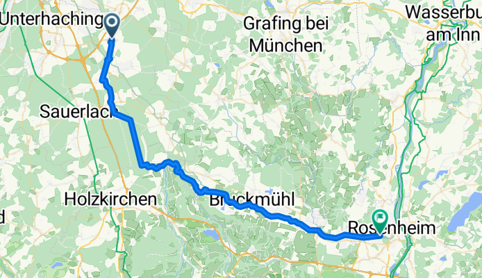
MTB_Hoh-Ro
A cycling route starting in Hohenbrunn, Bavaria, Germany.
Overview
About this route
- -:--
- Duration
- 51.2 km
- Distance
- 101 m
- Ascent
- 216 m
- Descent
- ---
- Avg. speed
- ---
- Max. altitude

Continue with Bikemap
Use, edit, or download this cycling route
You would like to ride MTB_Hoh-Ro or customize it for your own trip? Here is what you can do with this Bikemap route:
Free features
- Save this route as favorite or in collections
- Copy & plan your own version of this route
- Sync your route with Garmin or Wahoo
Premium features
Free trial for 3 days, or one-time payment. More about Bikemap Premium.
- Navigate this route on iOS & Android
- Export a GPX / KML file of this route
- Create your custom printout (try it for free)
- Download this route for offline navigation
Discover more Premium features.
Get Bikemap PremiumFrom our community
Other popular routes starting in Hohenbrunn
 Aying - Glonn - Egmating
- Distance
- 45.7 km
- Ascent
- 201 m
- Descent
- 201 m
- Location
- Hohenbrunn, Bavaria, Germany
 Aying und zurück
- Distance
- 27.3 km
- Ascent
- 193 m
- Descent
- 202 m
- Location
- Hohenbrunn, Bavaria, Germany
 Jakobsweg von Ottobrunn - Lindau/Bodensee (D)
- Distance
- 264.7 km
- Ascent
- 2,336 m
- Descent
- 2,200 m
- Location
- Hohenbrunn, Bavaria, Germany
 CaffeeMomm
- Distance
- 22.9 km
- Ascent
- 103 m
- Descent
- 106 m
- Location
- Hohenbrunn, Bavaria, Germany
 Munich (suburbs) to Gmund at Tegernsee
- Distance
- 40.3 km
- Ascent
- 265 m
- Descent
- 95 m
- Location
- Hohenbrunn, Bavaria, Germany
 Lange Oberlandrunde
- Distance
- 44.7 km
- Ascent
- 1,348 m
- Descent
- 1,035 m
- Location
- Hohenbrunn, Bavaria, Germany
 RR Riemerling-Dietramszell-PupplingerAu-Riemerling
- Distance
- 92.7 km
- Ascent
- 396 m
- Descent
- 398 m
- Location
- Hohenbrunn, Bavaria, Germany
 Moderate Route in Hohenbrunn
- Distance
- 10.8 km
- Ascent
- 604 m
- Descent
- 553 m
- Location
- Hohenbrunn, Bavaria, Germany
Open it in the app