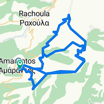
Thessalia18 day_3
A cycling route starting in Kallíthiro, Thessaly, Greece.
Overview
About this route
- -:--
- Duration
- 31.3 km
- Distance
- 620 m
- Ascent
- 609 m
- Descent
- ---
- Avg. speed
- ---
- Avg. speed
Route quality
Waytypes & surfaces along the route
Waytypes
Busy road
23.5 km
(75 %)
Road
4.5 km
(14 %)
Surfaces
Paved
25.2 km
(81 %)
Unpaved
1.9 km
(6 %)
Asphalt
25.2 km
(81 %)
Gravel
1.2 km
(4 %)
Continue with Bikemap
Use, edit, or download this cycling route
You would like to ride Thessalia18 day_3 or customize it for your own trip? Here is what you can do with this Bikemap route:
Free features
- Save this route as favorite or in collections
- Copy & plan your own version of this route
- Sync your route with Garmin or Wahoo
Premium features
Free trial for 3 days, or one-time payment. More about Bikemap Premium.
- Navigate this route on iOS & Android
- Export a GPX / KML file of this route
- Create your custom printout (try it for free)
- Download this route for offline navigation
Discover more Premium features.
Get Bikemap PremiumFrom our community
Other popular routes starting in Kallíthiro
- Ελεύθερα Βουνά, Ιούλιος 2020
- Distance
- 212.4 km
- Ascent
- 3,938 m
- Descent
- 3,939 m
- Location
- Kallíthiro, Thessaly, Greece
- Lake Plastira - Niala - Agrafa
- Distance
- 45.6 km
- Ascent
- 1,337 m
- Descent
- 1,331 m
- Location
- Kallíthiro, Thessaly, Greece
- Gyros limnis plastira
- Distance
- 58.1 km
- Ascent
- 904 m
- Descent
- 904 m
- Location
- Kallíthiro, Thessaly, Greece
- Thessalia18 day_3
- Distance
- 31.3 km
- Ascent
- 620 m
- Descent
- 609 m
- Location
- Kallíthiro, Thessaly, Greece
- 2022--Asklipios-Route--tmima2o9
- Distance
- 182.1 km
- Ascent
- 5,613 m
- Descent
- 6,776 m
- Location
- Kallíthiro, Thessaly, Greece
- Expedition_save_agrafa_2021
- Distance
- 391.9 km
- Ascent
- 8,138 m
- Descent
- 6,912 m
- Location
- Kallíthiro, Thessaly, Greece
- Sarantaporo - Anthiro
- Distance
- 14.6 km
- Ascent
- 519 m
- Descent
- 584 m
- Location
- Kallíthiro, Thessaly, Greece
Open it in the app