

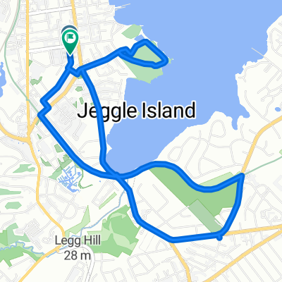
St Johns to Cove
A cycling route starting in Salem, Massachusetts, United States.
Overview
About this route
- -:--
- Duration
- 18.6 km
- Distance
- 117 m
- Ascent
- 116 m
- Descent
- ---
- Avg. speed
- ---
- Max. altitude

Continue with Bikemap
Use, edit, or download this cycling route
You would like to ride St Johns to Cove or customize it for your own trip? Here is what you can do with this Bikemap route:
Free features
- Save this route as favorite or in collections
- Copy & plan your own version of this route
- Sync your route with Garmin or Wahoo
Premium features
Free trial for 3 days, or one-time payment. More about Bikemap Premium.
- Navigate this route on iOS & Android
- Export a GPX / KML file of this route
- Create your custom printout (try it for free)
- Download this route for offline navigation
Discover more Premium features.
Get Bikemap PremiumFrom our community
Other popular routes starting in Salem
 Bike Path and Forest River Loops
- Distance
- 7.1 km
- Ascent
- 50 m
- Descent
- 47 m
- Location
- Salem, Massachusetts, United States
 Ward Street 10, Salem to Ward Street 10, Salem
- Distance
- 8.8 km
- Ascent
- 84 m
- Descent
- 84 m
- Location
- Salem, Massachusetts, United States
 Bike to School
- Distance
- 3.4 km
- Ascent
- 28 m
- Descent
- 14 m
- Location
- Salem, Massachusetts, United States
 Washington Street 120, Salem to North Street 130 1/2, Salem
- Distance
- 4 km
- Ascent
- 36 m
- Descent
- 3 m
- Location
- Salem, Massachusetts, United States
 To Marblehead
- Distance
- 12.3 km
- Ascent
- 54 m
- Descent
- 51 m
- Location
- Salem, Massachusetts, United States
 St Johns to the Farms
- Distance
- 18.6 km
- Ascent
- 87 m
- Descent
- 97 m
- Location
- Salem, Massachusetts, United States
 Salem Marblehead Loop
- Distance
- 35 km
- Ascent
- 111 m
- Descent
- 113 m
- Location
- Salem, Massachusetts, United States
 St Johns to Cove
- Distance
- 18.6 km
- Ascent
- 117 m
- Descent
- 116 m
- Location
- Salem, Massachusetts, United States
Open it in the app