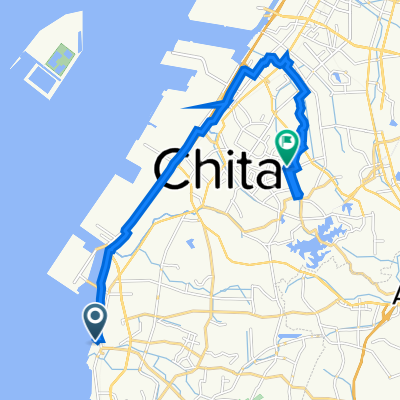
Japan-trip
A cycling route starting in Tokoname, Aichi, Japan.
Overview
About this route
Nagoya Chubu Centrair Airport
Fujikawaguchiko
Fujisan
Tokyo
Fujikawaguchiko
Fujisan
Takayama
Amanohashidate
Himeji
Kyoto
Nara
Ise
Shima
Ise
Toba
Shima
Tsu
Iga-city
Nagoya
Nagoya Chubu Centrair Airport
- -:--
- Duration
- 2,255.8 km
- Distance
- 6,575 m
- Ascent
- 6,574 m
- Descent
- ---
- Avg. speed
- ---
- Avg. speed
Continue with Bikemap
Use, edit, or download this cycling route
You would like to ride Japan-trip or customize it for your own trip? Here is what you can do with this Bikemap route:
Free features
- Save this route as favorite or in collections
- Copy & plan your own version of this route
- Sync your route with Garmin or Wahoo
Premium features
Free trial for 3 days, or one-time payment. More about Bikemap Premium.
- Navigate this route on iOS & Android
- Export a GPX / KML file of this route
- Create your custom printout (try it for free)
- Download this route for offline navigation
Discover more Premium features.
Get Bikemap PremiumFrom our community
Other popular routes starting in Tokoname
- ⑬萬緑 知多運動公園
- Distance
- 6.5 km
- Ascent
- 36 m
- Descent
- 36 m
- Location
- Tokoname, Aichi, Japan
- Japan-trip
- Distance
- 2,255.8 km
- Ascent
- 6,575 m
- Descent
- 6,574 m
- Location
- Tokoname, Aichi, Japan
- Easy ride in Chita-Shi
- Distance
- 13.4 km
- Ascent
- 0 m
- Descent
- 13 m
- Location
- Tokoname, Aichi, Japan
- 9−2, 常滑市 to 岐阜市
- Distance
- 70.6 km
- Ascent
- 622 m
- Descent
- 638 m
- Location
- Tokoname, Aichi, Japan
- 9−2, 常滑市 to 東丸山, 東海市
- Distance
- 20.1 km
- Ascent
- 265 m
- Descent
- 282 m
- Location
- Tokoname, Aichi, Japan
- nagoya 2013
- Distance
- 763.2 km
- Ascent
- 8,279 m
- Descent
- 8,278 m
- Location
- Tokoname, Aichi, Japan
- csita
- Distance
- 132.6 km
- Ascent
- 1,444 m
- Descent
- 1,419 m
- Location
- Tokoname, Aichi, Japan
- Chita 70.3 Bike course
- Distance
- 90.1 km
- Ascent
- 172 m
- Descent
- 126 m
- Location
- Tokoname, Aichi, Japan
Open it in the app