Giro di Cervinia
A cycling route starting in Châtillon, Aosta Valley, Italy.
Overview
About this route
- -:--
- Duration
- 56.8 km
- Distance
- 1,747 m
- Ascent
- 1,744 m
- Descent
- ---
- Avg. speed
- 2,002 m
- Max. altitude
Route quality
Waytypes & surfaces along the route
Waytypes
Quiet road
5.1 km
(9 %)
Access road
1.7 km
(3 %)
Surfaces
Paved
32.4 km
(57 %)
Unpaved
0.6 km
(1 %)
Asphalt
32.4 km
(57 %)
Ground
0.6 km
(1 %)
Undefined
23.9 km
(42 %)
Continue with Bikemap
Use, edit, or download this cycling route
You would like to ride Giro di Cervinia or customize it for your own trip? Here is what you can do with this Bikemap route:
Free features
- Save this route as favorite or in collections
- Copy & plan your own version of this route
- Sync your route with Garmin or Wahoo
Premium features
Free trial for 3 days, or one-time payment. More about Bikemap Premium.
- Navigate this route on iOS & Android
- Export a GPX / KML file of this route
- Create your custom printout (try it for free)
- Download this route for offline navigation
Discover more Premium features.
Get Bikemap PremiumFrom our community
Other popular routes starting in Châtillon
- Chatillon - St Jean des Allemands
- Distance
- 82 km
- Ascent
- 2,058 m
- Descent
- 2,085 m
- Location
- Châtillon, Aosta Valley, Italy
- Col Saint Pantaleon e Cervinia
- Distance
- 78.7 km
- Ascent
- 2,486 m
- Descent
- 2,487 m
- Location
- Châtillon, Aosta Valley, Italy
- Chatilon-Cervinia
- Distance
- 27.8 km
- Ascent
- 1,495 m
- Descent
- 0 m
- Location
- Châtillon, Aosta Valley, Italy
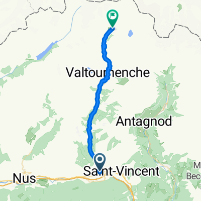
- Via Tour de Grange 58, Chatillon to Via delle Guide 37, Ayas
- Distance
- 31.8 km
- Ascent
- 1,412 m
- Descent
- 384 m
- Location
- Châtillon, Aosta Valley, Italy
- Giro di Cervinia
- Distance
- 56.8 km
- Ascent
- 1,747 m
- Descent
- 1,744 m
- Location
- Châtillon, Aosta Valley, Italy
- Etape Giro 2018
- Distance
- 99.8 km
- Ascent
- 3,480 m
- Descent
- 1,993 m
- Location
- Châtillon, Aosta Valley, Italy
- Chatillon - St Jean des Allemands
- Distance
- 84.9 km
- Ascent
- 1,820 m
- Descent
- 1,857 m
- Location
- Châtillon, Aosta Valley, Italy
- Frankovska_D_13
- Distance
- 90.7 km
- Ascent
- 339 m
- Descent
- 644 m
- Location
- Châtillon, Aosta Valley, Italy
Open it in the app