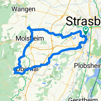
STBG - Hornisgrinde - STBG
A cycling route starting in Ostwald, Grand Est, France.
Overview
About this route
- -:--
- Duration
- 100.9 km
- Distance
- 937 m
- Ascent
- 936 m
- Descent
- ---
- Avg. speed
- ---
- Max. altitude
Route quality
Waytypes & surfaces along the route
Waytypes
Track
19.2 km
(19 %)
Quiet road
14.1 km
(14 %)
Surfaces
Paved
81.8 km
(81 %)
Unpaved
9.1 km
(9 %)
Asphalt
77.7 km
(77 %)
Gravel
5 km
(5 %)
Continue with Bikemap
Use, edit, or download this cycling route
You would like to ride STBG - Hornisgrinde - STBG or customize it for your own trip? Here is what you can do with this Bikemap route:
Free features
- Save this route as favorite or in collections
- Copy & plan your own version of this route
- Split it into stages to create a multi-day tour
- Sync your route with Garmin or Wahoo
Premium features
Free trial for 3 days, or one-time payment. More about Bikemap Premium.
- Navigate this route on iOS & Android
- Export a GPX / KML file of this route
- Create your custom printout (try it for free)
- Download this route for offline navigation
Discover more Premium features.
Get Bikemap PremiumFrom our community
Other popular routes starting in Ostwald
- 166 Rue du Général Leclerc, Strasbourg à 126 Rue du Général de Gaulle, Dinsheim-sur-Bruche
- Distance
- 67.6 km
- Ascent
- 1,039 m
- Descent
- 977 m
- Location
- Ostwald, Grand Est, France
- Piste des forts - P2 France
- Distance
- 54.6 km
- Ascent
- 94 m
- Descent
- 93 m
- Location
- Ostwald, Grand Est, France
- 41 Rue de Westhoffen, Strasbourg à 87 Rue d'Ostwald, Strasbourg
- Distance
- 63.6 km
- Ascent
- 1,393 m
- Descent
- 1,393 m
- Location
- Ostwald, Grand Est, France
- STBG - Hornisgrinde - STBG
- Distance
- 100.9 km
- Ascent
- 937 m
- Descent
- 936 m
- Location
- Ostwald, Grand Est, France
- 75 Rue d'Ostwald, Strasbourg à 77 Rue d'Ostwald, Strasbourg
- Distance
- 83.6 km
- Ascent
- 759 m
- Descent
- 758 m
- Location
- Ostwald, Grand Est, France
- Rue du Doubs 18, Strasbourg nach Rue des Tuileries 2, Rhinau
- Distance
- 29.2 km
- Ascent
- 83 m
- Descent
- 117 m
- Location
- Ostwald, Grand Est, France
- Boucle Mont Sainte-Odile 90 km
- Distance
- 88.9 km
- Ascent
- 706 m
- Descent
- 706 m
- Location
- Ostwald, Grand Est, France
- De Rue du Général Leclerc 60, Ostwald à Rue de l'Île des Pêcheurs 1, Ostwald
- Distance
- 21.3 km
- Ascent
- 37 m
- Descent
- 89 m
- Location
- Ostwald, Grand Est, France
Open it in the app