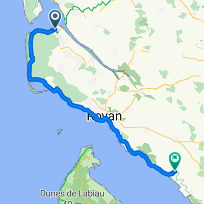
Ronce-les-Bains - La Palmyre - Arvert -
- 37.5 km
- 89 m
- 87 m
- La Tremblade, Nouvelle-Aquitaine, France
A cycling route starting in La Tremblade, Nouvelle-Aquitaine, France.
Overview
Route quality
Cycleway
23.6 km
(63 %)
Quiet road
4.1 km
(11 %)
Paved
26.6 km
(71 %)
Unpaved
0.7 km
(2 %)
Asphalt
26.2 km
(70 %)
Ground
0.7 km
(2 %)
Continue with Bikemap
You would like to ride Ronce-les-Bains - La Palmyre - Arvert - or customize it for your own trip? Here is what you can do with this Bikemap route:
Free trial for 3 days, or one-time payment. More about Bikemap Premium.
Discover more Premium features.
Get Bikemap PremiumFrom our community
Open it in the app