

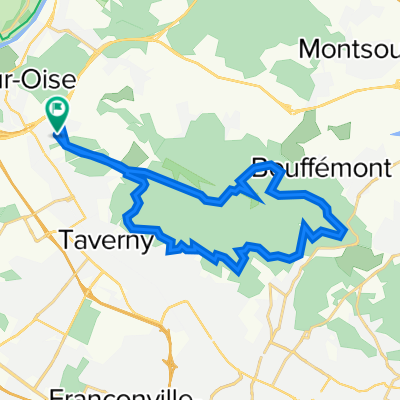
Montmorency
A cycling route starting in Frépillon, Île-de-France Region, France.
Overview
About this route
- -:--
- Duration
- 23.3 km
- Distance
- 319 m
- Ascent
- 317 m
- Descent
- ---
- Avg. speed
- ---
- Max. altitude

Route quality
Waytypes & surfaces along the route
Waytypes
Path
18.7 km
(80 %)
Access road
1.6 km
(7 %)
Surfaces
Paved
1.2 km
(5 %)
Unpaved
4.9 km
(21 %)
Ground
4 km
(17 %)
Asphalt
0.9 km
(4 %)
Continue with Bikemap
Use, edit, or download this cycling route
You would like to ride Montmorency or customize it for your own trip? Here is what you can do with this Bikemap route:
Free features
- Save this route as favorite or in collections
- Copy & plan your own version of this route
- Sync your route with Garmin or Wahoo
Premium features
Free trial for 3 days, or one-time payment. More about Bikemap Premium.
- Navigate this route on iOS & Android
- Export a GPX / KML file of this route
- Create your custom printout (try it for free)
- Download this route for offline navigation
Discover more Premium features.
Get Bikemap PremiumFrom our community
Other popular routes starting in Frépillon
 De Route Départementale, Béthemont-la-Forêt à 24 Rue Pradine, Saint-Ouen-l'Aumône
- Distance
- 12.3 km
- Ascent
- 77 m
- Descent
- 197 m
- Location
- Frépillon, Île-de-France Region, France
 2 Rue de la Croix Frileuse, Béthemont-la-Forêt à Amstel 1–3, Amsterdam
- Distance
- 541.5 km
- Ascent
- 2,109 m
- Descent
- 2,258 m
- Location
- Frépillon, Île-de-France Region, France
 Montmorency
- Distance
- 23.3 km
- Ascent
- 319 m
- Descent
- 317 m
- Location
- Frépillon, Île-de-France Region, France
 De Rue du Coudray 2, Frépillon à Avenue du Muguet 31, Soisy-sous-Montmorency
- Distance
- 10.9 km
- Ascent
- 18 m
- Descent
- 66 m
- Location
- Frépillon, Île-de-France Region, France
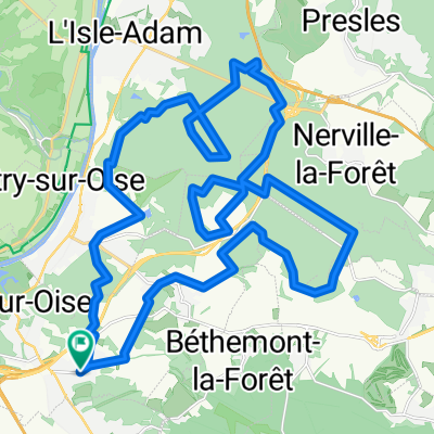 Frepillon Cool
- Distance
- 33.1 km
- Ascent
- 285 m
- Descent
- 286 m
- Location
- Frépillon, Île-de-France Region, France
 Petit Tour Dans le Vexin
- Distance
- 96.6 km
- Ascent
- 486 m
- Descent
- 486 m
- Location
- Frépillon, Île-de-France Region, France
 De 26 Rue Henri-François Riesener, Frépillon à 19 Rue du Val d'Oise, Parmain
- Distance
- 8 km
- Ascent
- 12 m
- Descent
- 71 m
- Location
- Frépillon, Île-de-France Region, France
 14 Impasse de la Tronche, Frépillon to 14 Rue de Saint-Prix, Eaubonne
- Distance
- 9.6 km
- Ascent
- 0 m
- Descent
- 20 m
- Location
- Frépillon, Île-de-France Region, France
Open it in the app