
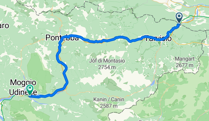
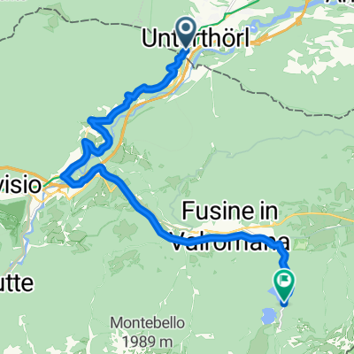
Unterthörl-Resiuta
A cycling route starting in Hohenthurn, Carinthia, Austria.
Overview
About this route
- -:--
- Duration
- 51.1 km
- Distance
- 208 m
- Ascent
- 565 m
- Descent
- ---
- Avg. speed
- ---
- Max. altitude

Route quality
Waytypes & surfaces along the route
Waytypes
Cycleway
32.4 km
(63 %)
Quiet road
9.3 km
(18 %)
Surfaces
Paved
47.6 km
(93 %)
Unpaved
0.8 km
(2 %)
Asphalt
47.1 km
(92 %)
Ground
0.7 km
(1 %)
Continue with Bikemap
Use, edit, or download this cycling route
You would like to ride Unterthörl-Resiuta or customize it for your own trip? Here is what you can do with this Bikemap route:
Free features
- Save this route as favorite or in collections
- Copy & plan your own version of this route
- Sync your route with Garmin or Wahoo
Premium features
Free trial for 3 days, or one-time payment. More about Bikemap Premium.
- Navigate this route on iOS & Android
- Export a GPX / KML file of this route
- Create your custom printout (try it for free)
- Download this route for offline navigation
Discover more Premium features.
Get Bikemap PremiumFrom our community
Other popular routes starting in Hohenthurn
 MTB-Trail: ThörlMaglernZoll-Pressendellach-Draschitz-Göriach-Achomitz-AchomitzerAlm-TRAIL-WW508-ArlecchinoTRAIL-Camporosso-Tarvisio-Coccau-ThörlMaglernZoll
- Distance
- 37.4 km
- Ascent
- 1,474 m
- Descent
- 1,470 m
- Location
- Hohenthurn, Carinthia, Austria
 Von Arnoldstein bis lago di fusine
- Distance
- 15.5 km
- Ascent
- 691 m
- Descent
- 413 m
- Location
- Hohenthurn, Carinthia, Austria
 soca
soca- Distance
- 99.4 km
- Ascent
- 2,367 m
- Descent
- 2,353 m
- Location
- Hohenthurn, Carinthia, Austria
 sLOVEnia
- Distance
- 456.7 km
- Ascent
- 8,412 m
- Descent
- 8,414 m
- Location
- Hohenthurn, Carinthia, Austria
 Tarvis Bled
- Distance
- 59.8 km
- Ascent
- 831 m
- Descent
- 1,011 m
- Location
- Hohenthurn, Carinthia, Austria
 Hohenthurn Radfahren
- Distance
- 97.3 km
- Ascent
- 1,262 m
- Descent
- 1,245 m
- Location
- Hohenthurn, Carinthia, Austria
 Bad Bleiberg - Villacher Alpenstraße
- Distance
- 34.3 km
- Ascent
- 1,568 m
- Descent
- 468 m
- Location
- Hohenthurn, Carinthia, Austria
 🚴♀️E*Bike🇦🇹 17.05.20. 4. Tag Kanatalradweg
- Distance
- 53.1 km
- Ascent
- 304 m
- Descent
- 636 m
- Location
- Hohenthurn, Carinthia, Austria
Open it in the app