WALK - Trimley Marshes circular (5.98 miles).gpx
- 9.7 km
- 55 m
- 56 m
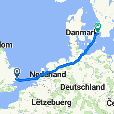
- Felixstowe, England, United Kingdom
A cycling route starting in Felixstowe, England, United Kingdom.
Overview
created this 7 years ago
Route quality
Road
52.7 km
(42 %)
Quiet road
16.3 km
(13 %)
Paved
51.4 km
(41 %)
Asphalt
51.4 km
(41 %)
Undefined
74 km
(59 %)
Route highlights
Red Lion Shandy Stop
Alton Water Coffee Stop
Fish & Chip Dinner
Fludgers Arms
Ferry Crossing
Continue with Bikemap
You would like to ride Full Route In One or customize it for your own trip? Here is what you can do with this Bikemap route:
Free trial for 3 days, or one-time payment. More about Bikemap Premium.
Discover more Premium features.
Get Bikemap PremiumFrom our community
Open it in the app