

Vélo 2
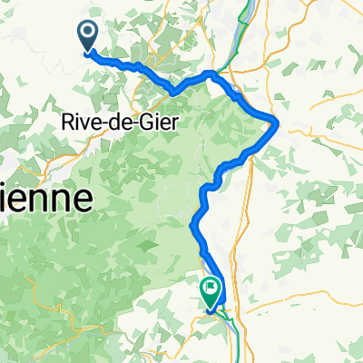
A cycling route starting in Saint-Didier-sous-Riverie, Auvergne-Rhône-Alpes, France.
Overview
About this route
écriture
- -:--
- Duration
- 91.8 km
- Distance
- 696 m
- Ascent
- 990 m
- Descent
- ---
- Avg. speed
- ---
- Max. altitude
Route highlights
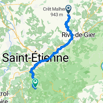
Points of interest along the route
Point of interest after 26.6 km
arret strava
Point of interest after 27.6 km
remettre strava
Continue with Bikemap
Use, edit, or download this cycling route
You would like to ride Vélo 2 or customize it for your own trip? Here is what you can do with this Bikemap route:
Free features
- Save this route as favorite or in collections
- Copy & plan your own version of this route
- Split it into stages to create a multi-day tour
- Sync your route with Garmin or Wahoo
Premium features
Free trial for 3 days, or one-time payment. More about Bikemap Premium.
- Navigate this route on iOS & Android
- Export a GPX / KML file of this route
- Create your custom printout (try it for free)
- Download this route for offline navigation
Discover more Premium features.
Get Bikemap PremiumFrom our community
Other popular routes starting in Saint-Didier-sous-Riverie
 De Sainte-Catherine à Serrières
- Distance
- 65.9 km
- Ascent
- 434 m
- Descent
- 986 m
- Location
- Saint-Didier-sous-Riverie, Auvergne-Rhône-Alpes, France
 St Didier/Taluyers
- Distance
- 14.5 km
- Ascent
- 156 m
- Descent
- 376 m
- Location
- Saint-Didier-sous-Riverie, Auvergne-Rhône-Alpes, France
 De Rue de la Patinoire 134, Sainte-Catherine à La Pelaude 80, Vaugneray
- Distance
- 23 km
- Ascent
- 427 m
- Descent
- 724 m
- Location
- Saint-Didier-sous-Riverie, Auvergne-Rhône-Alpes, France
 Mornant Pajay
- Distance
- 63.1 km
- Ascent
- 660 m
- Descent
- 858 m
- Location
- Saint-Didier-sous-Riverie, Auvergne-Rhône-Alpes, France
 boucles dans les monts et coteaux
- Distance
- 70.7 km
- Ascent
- 1,389 m
- Descent
- 1,389 m
- Location
- Saint-Didier-sous-Riverie, Auvergne-Rhône-Alpes, France
 Saint-Didier-sous-Riverie - Jonzieux
- Distance
- 53.1 km
- Ascent
- 1,372 m
- Descent
- 1,211 m
- Location
- Saint-Didier-sous-Riverie, Auvergne-Rhône-Alpes, France
 Vélo 2
- Distance
- 91.8 km
- Ascent
- 696 m
- Descent
- 990 m
- Location
- Saint-Didier-sous-Riverie, Auvergne-Rhône-Alpes, France
 GraphHopper Track
- Distance
- 136.9 km
- Ascent
- 702 m
- Descent
- 801 m
- Location
- Saint-Didier-sous-Riverie, Auvergne-Rhône-Alpes, France
Open it in the app