

BRM 400 Teil 2
A cycling route starting in Rehetobel, Canton of Appenzell Ausserrhoden, Switzerland.
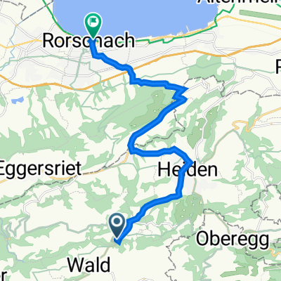
Overview
About this route
- -:--
- Duration
- 101.4 km
- Distance
- 2,170 m
- Ascent
- 2,248 m
- Descent
- ---
- Avg. speed
- ---
- Max. altitude

Route quality
Waytypes & surfaces along the route
Waytypes
Road
30.4 km
(30 %)
Track
19.3 km
(19 %)
Surfaces
Paved
81.1 km
(80 %)
Unpaved
8.1 km
(8 %)
Asphalt
76 km
(75 %)
Gravel
8.1 km
(8 %)
Continue with Bikemap
Use, edit, or download this cycling route
You would like to ride BRM 400 Teil 2 or customize it for your own trip? Here is what you can do with this Bikemap route:
Free features
- Save this route as favorite or in collections
- Copy & plan your own version of this route
- Split it into stages to create a multi-day tour
- Sync your route with Garmin or Wahoo
Premium features
Free trial for 3 days, or one-time payment. More about Bikemap Premium.
- Navigate this route on iOS & Android
- Export a GPX / KML file of this route
- Create your custom printout (try it for free)
- Download this route for offline navigation
Discover more Premium features.
Get Bikemap PremiumFrom our community
Other popular routes starting in Rehetobel
 Rehetobel - Appenzell- Gais - Stoss - Altstätten - Ruppen - St. Anton - Oberegg - Rehetobel
- Distance
- 53 km
- Ascent
- 1,116 m
- Descent
- 1,114 m
- Location
- Rehetobel, Canton of Appenzell Ausserrhoden, Switzerland
 Recovered Route
- Distance
- 12.6 km
- Ascent
- 72 m
- Descent
- 657 m
- Location
- Rehetobel, Canton of Appenzell Ausserrhoden, Switzerland
 Rehetobel Teufen
- Distance
- 14.5 km
- Ascent
- 313 m
- Descent
- 407 m
- Location
- Rehetobel, Canton of Appenzell Ausserrhoden, Switzerland
 Rehetobel - Appenzell - Weissbad - Schwägalp - Urnäsch - Teufen - Rehetobel
- Distance
- 75.6 km
- Ascent
- 1,811 m
- Descent
- 1,813 m
- Location
- Rehetobel, Canton of Appenzell Ausserrhoden, Switzerland
 BRM 400 Teil 2
- Distance
- 101.4 km
- Ascent
- 2,170 m
- Descent
- 2,248 m
- Location
- Rehetobel, Canton of Appenzell Ausserrhoden, Switzerland
 Nasenstrasse 14, Rehetobel nach Hauptstraße 10, Bodman-Ludwigshafen
- Distance
- 90.3 km
- Ascent
- 602 m
- Descent
- 1,181 m
- Location
- Rehetobel, Canton of Appenzell Ausserrhoden, Switzerland
 Recovered Route
- Distance
- 12.7 km
- Ascent
- 76 m
- Descent
- 662 m
- Location
- Rehetobel, Canton of Appenzell Ausserrhoden, Switzerland
 Nasenstrasse 18, Rehetobel nach Nasenstrasse 18, Rehetobel
- Distance
- 82.1 km
- Ascent
- 1,350 m
- Descent
- 1,348 m
- Location
- Rehetobel, Canton of Appenzell Ausserrhoden, Switzerland
Open it in the app