

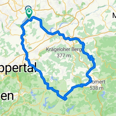
Witten-Duisburg - Ruhrtal-Radweg -
A cycling route starting in Witten, North Rhine-Westphalia, Germany.
Overview
About this route
- -:--
- Duration
- 82.9 km
- Distance
- 145 m
- Ascent
- 202 m
- Descent
- ---
- Avg. speed
- ---
- Max. altitude

Route quality
Waytypes & surfaces along the route
Waytypes
Path
34.1 km
(41 %)
Quiet road
17.8 km
(22 %)
Surfaces
Paved
74.6 km
(90 %)
Unpaved
6.7 km
(8 %)
Asphalt
68.7 km
(83 %)
Gravel
6.3 km
(8 %)
Continue with Bikemap
Use, edit, or download this cycling route
You would like to ride Witten-Duisburg - Ruhrtal-Radweg - or customize it for your own trip? Here is what you can do with this Bikemap route:
Free features
- Save this route as favorite or in collections
- Copy & plan your own version of this route
- Split it into stages to create a multi-day tour
- Sync your route with Garmin or Wahoo
Premium features
Free trial for 3 days, or one-time payment. More about Bikemap Premium.
- Navigate this route on iOS & Android
- Export a GPX / KML file of this route
- Create your custom printout (try it for free)
- Download this route for offline navigation
Discover more Premium features.
Get Bikemap PremiumFrom our community
Other popular routes starting in Witten
 Grosse Muttentalrunde
- Distance
- 38.9 km
- Ascent
- 515 m
- Descent
- 515 m
- Location
- Witten, North Rhine-Westphalia, Germany
 18.10.2008 Matal Motion Bike Freunde Herbede
- Distance
- 38.2 km
- Ascent
- 363 m
- Descent
- 360 m
- Location
- Witten, North Rhine-Westphalia, Germany
 Witten-Duisburg - Ruhrtal-Radweg -
- Distance
- 82.9 km
- Ascent
- 145 m
- Descent
- 202 m
- Location
- Witten, North Rhine-Westphalia, Germany
 ketteimmerrechts.de // kir-ig.de
- Distance
- 49.7 km
- Ascent
- 455 m
- Descent
- 458 m
- Location
- Witten, North Rhine-Westphalia, Germany
 Lahmen Hasen V3
- Distance
- 109.4 km
- Ascent
- 842 m
- Descent
- 841 m
- Location
- Witten, North Rhine-Westphalia, Germany
 Rundkurs ums Autobahnkreuz Do-West
- Distance
- 19.9 km
- Ascent
- 93 m
- Descent
- 94 m
- Location
- Witten, North Rhine-Westphalia, Germany
 Mountainbike 1
- Distance
- 32.1 km
- Ascent
- 232 m
- Descent
- 230 m
- Location
- Witten, North Rhine-Westphalia, Germany
 Do-Oespel - Sprockhövel - Do-Oespel
- Distance
- 45.7 km
- Ascent
- 344 m
- Descent
- 344 m
- Location
- Witten, North Rhine-Westphalia, Germany
Open it in the app