Ostrawa Hermanice, Micha艂kowice
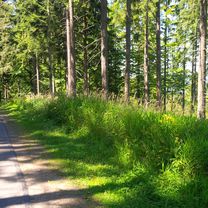
A cycling route starting in Cieszyn, Silesian Voivodeship, Poland.
Overview
About this route
- -:--
- Duration
- 84.1 km
- Distance
- 425 m
- Ascent
- 425 m
- Descent
- ---
- Avg. speed
- ---
- Avg. speed
Route quality
Waytypes & surfaces along the route
Waytypes
Quiet road
24.2 km
(29 %)
Busy road
17.7 km
(21 %)
Surfaces
Paved
44.8 km
(53 %)
Unpaved
0.4 km
(<1 %)
Asphalt
41.5 km
(49 %)
Paved (undefined)
2.8 km
(3 %)
Continue with Bikemap
Use, edit, or download this cycling route
You would like to ride Ostrawa Hermanice, Micha艂kowice or customize it for your own trip? Here is what you can do with this Bikemap route:
Free features
- Save this route as favorite or in collections
- Copy & plan your own version of this route
- Sync your route with Garmin or Wahoo
Premium features
Free trial for 3 days, or one-time payment. More about Bikemap Premium.
- Navigate this route on iOS & Android
- Export a GPX / KML file of this route
- Create your custom printout (try it for free)
- Download this route for offline navigation
Discover more Premium features.
Get Bikemap PremiumFrom our community
Other popular routes starting in Cieszyn
- Po pracy drog膮 okr臋偶n膮 :)
- Distance
- 80.9 km
- Ascent
- 725 m
- Descent
- 725 m
- Location
- Cieszyn, Silesian Voivodeship, Poland
- Karvin谩
- Distance
- 33.4 km
- Ascent
- 143 m
- Descent
- 144 m
- Location
- Cieszyn, Silesian Voivodeship, Poland
- GreenWays Cieszyn - Wiede艅 (Cracow - Vien)
- Distance
- 427.5 km
- Ascent
- 972 m
- Descent
- 1,104 m
- Location
- Cieszyn, Silesian Voivodeship, Poland
- W Dolomity (12 dni) 2002r
- Distance
- 2,273.5 km
- Ascent
- 34,645 m
- Descent
- 34,441 m
- Location
- Cieszyn, Silesian Voivodeship, Poland
- Wielka Czantoria z Nydku dol. potoku Strzelma
- Distance
- 49.4 km
- Ascent
- 897 m
- Descent
- 897 m
- Location
- Cieszyn, Silesian Voivodeship, Poland
- Cieszyn-Dziegielow-Goleszow-Puncow-Cieszyn
- Distance
- 24.3 km
- Ascent
- 271 m
- Descent
- 276 m
- Location
- Cieszyn, Silesian Voivodeship, Poland
- Cieszyn-Budzin-Tu艂-Cieszyn
- Distance
- 29 km
- Ascent
- 528 m
- Descent
- 528 m
- Location
- Cieszyn, Silesian Voivodeship, Poland
- Cieszyn-Tatry-Cieszyn
- Distance
- 371.9 km
- Ascent
- 2,669 m
- Descent
- 2,669 m
- Location
- Cieszyn, Silesian Voivodeship, Poland
Open it in the app