

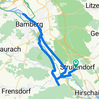
Regnitz / Kanaltour
A cycling route starting in Strullendorf, Bavaria, Germany.
Overview
About this route
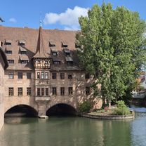
Magnificent views on the canal, idyllic spots along the Regnitz and the 'Rauhen Ebrach'
- -:--
- Duration
- 30.2 km
- Distance
- 78 m
- Ascent
- 78 m
- Descent
- ---
- Avg. speed
- ---
- Max. altitude

Route quality
Waytypes & surfaces along the route
Waytypes
Quiet road
9.3 km
(31 %)
Path
7.8 km
(26 %)
Surfaces
Paved
22.9 km
(76 %)
Unpaved
6.3 km
(21 %)
Asphalt
22.3 km
(74 %)
Gravel
5.4 km
(18 %)
Continue with Bikemap
Use, edit, or download this cycling route
You would like to ride Regnitz / Kanaltour or customize it for your own trip? Here is what you can do with this Bikemap route:
Free features
- Save this route as favorite or in collections
- Copy & plan your own version of this route
- Sync your route with Garmin or Wahoo
Premium features
Free trial for 3 days, or one-time payment. More about Bikemap Premium.
- Navigate this route on iOS & Android
- Export a GPX / KML file of this route
- Create your custom printout (try it for free)
- Download this route for offline navigation
Discover more Premium features.
Get Bikemap PremiumFrom our community
Other popular routes starting in Strullendorf
 6 Bamberg nach Neumarkt i. d. OPf.
- Distance
- 116.1 km
- Ascent
- 984 m
- Descent
- 866 m
- Location
- Strullendorf, Bavaria, Germany
 Friesener Warte, Geisberg
- Distance
- 33.9 km
- Ascent
- 492 m
- Descent
- 494 m
- Location
- Strullendorf, Bavaria, Germany
 Radrunde Nördliche Fränkische Schweiz
- Distance
- 152 km
- Ascent
- 892 m
- Descent
- 891 m
- Location
- Strullendorf, Bavaria, Germany
 Route to Hirschaid
- Distance
- 5.8 km
- Ascent
- 33 m
- Descent
- 17 m
- Location
- Strullendorf, Bavaria, Germany
 Regnitz / Kanaltour
- Distance
- 30.2 km
- Ascent
- 78 m
- Descent
- 78 m
- Location
- Strullendorf, Bavaria, Germany
 _Rundtour_Fränkische_Toskana
- Distance
- 53.3 km
- Ascent
- 528 m
- Descent
- 526 m
- Location
- Strullendorf, Bavaria, Germany
 Stettenberg Leesten (Ofr)
- Distance
- 54.9 km
- Ascent
- 271 m
- Descent
- 205 m
- Location
- Strullendorf, Bavaria, Germany
 Zeegenbachtal-Tour_ab_Strullendorf_Kirchen_Keller_und_Naturidylle
- Distance
- 22.9 km
- Ascent
- 305 m
- Descent
- 302 m
- Location
- Strullendorf, Bavaria, Germany
Open it in the app