

Vilstal- Lauterachtal-Radweg-Runde
A cycling route starting in Ensdorf, Bavaria, Germany.
Overview
About this route
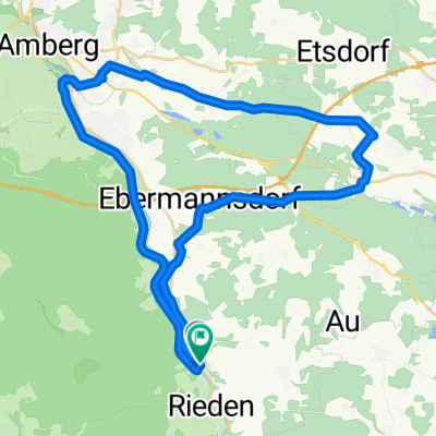
Ensdorf - Schmidmühlen - Hohenburg - Kastl - Ursensollen - Haselmühl - Ensdorf
- -:--
- Duration
- 66 km
- Distance
- 439 m
- Ascent
- 443 m
- Descent
- ---
- Avg. speed
- ---
- Max. altitude
Route quality
Waytypes & surfaces along the route
Waytypes
Track
26 km
(39 %)
Quiet road
12.9 km
(19 %)
Surfaces
Paved
38.8 km
(59 %)
Unpaved
23.8 km
(36 %)
Asphalt
34.9 km
(53 %)
Gravel
11 km
(17 %)
Continue with Bikemap
Use, edit, or download this cycling route
You would like to ride Vilstal- Lauterachtal-Radweg-Runde or customize it for your own trip? Here is what you can do with this Bikemap route:
Free features
- Save this route as favorite or in collections
- Copy & plan your own version of this route
- Sync your route with Garmin or Wahoo
Premium features
Free trial for 3 days, or one-time payment. More about Bikemap Premium.
- Navigate this route on iOS & Android
- Export a GPX / KML file of this route
- Create your custom printout (try it for free)
- Download this route for offline navigation
Discover more Premium features.
Get Bikemap PremiumFrom our community
Other popular routes starting in Ensdorf
 Ensdorf nach Stromerstraße 4, Kümmersbruck
- Distance
- 6.2 km
- Ascent
- 30 m
- Descent
- 42 m
- Location
- Ensdorf, Bavaria, Germany
 Test der Kallmünz Tria-Strecke
- Distance
- 73.4 km
- Ascent
- 547 m
- Descent
- 558 m
- Location
- Ensdorf, Bavaria, Germany
 Jeding-Amberger Runde
- Distance
- 43.1 km
- Ascent
- 251 m
- Descent
- 250 m
- Location
- Ensdorf, Bavaria, Germany
 Schwandorfer Straße 1, Ensdorf nach Schwandorfer Straße 1, Ensdorf
- Distance
- 62.2 km
- Ascent
- 853 m
- Descent
- 856 m
- Location
- Ensdorf, Bavaria, Germany
 Freihöls- Amberger Runde
- Distance
- 40.4 km
- Ascent
- 266 m
- Descent
- 265 m
- Location
- Ensdorf, Bavaria, Germany
 Langdistanz Trainingsfahrt
- Distance
- 145.6 km
- Ascent
- 666 m
- Descent
- 668 m
- Location
- Ensdorf, Bavaria, Germany
 Testrunde zur challenge-Radrunde
- Distance
- 161 km
- Ascent
- 746 m
- Descent
- 727 m
- Location
- Ensdorf, Bavaria, Germany
 Sonntags-Runde
- Distance
- 103.8 km
- Ascent
- 828 m
- Descent
- 880 m
- Location
- Ensdorf, Bavaria, Germany
Open it in the app