

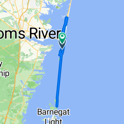
Cattus Island - Mantoloking Bridge
A cycling route starting in Seaside Park, New Jersey, United States.
Overview
About this route
- -:--
- Duration
- 40.9 km
- Distance
- 20 m
- Ascent
- 18 m
- Descent
- ---
- Avg. speed
- ---
- Max. altitude
Route quality
Waytypes & surfaces along the route
Waytypes
Quiet road
14 km
(34 %)
Busy road
12 km
(29 %)
Surfaces
Paved
21.2 km
(52 %)
Asphalt
18.3 km
(45 %)
Paved (undefined)
2.7 km
(6 %)
Continue with Bikemap
Use, edit, or download this cycling route
You would like to ride Cattus Island - Mantoloking Bridge or customize it for your own trip? Here is what you can do with this Bikemap route:
Free features
- Save this route as favorite or in collections
- Copy & plan your own version of this route
- Sync your route with Garmin or Wahoo
Premium features
Free trial for 3 days, or one-time payment. More about Bikemap Premium.
- Navigate this route on iOS & Android
- Export a GPX / KML file of this route
- Create your custom printout (try it for free)
- Download this route for offline navigation
Discover more Premium features.
Get Bikemap PremiumFrom our community
Other popular routes starting in Seaside Park
 1301–1399 NW Central Ave, Seaside Park to 1307 NW Central Ave, Seaside Park
- Distance
- 25 km
- Ascent
- 20 m
- Descent
- 20 m
- Location
- Seaside Park, New Jersey, United States
 Cattus Island - Mantoloking Bridge
- Distance
- 40.9 km
- Ascent
- 20 m
- Descent
- 18 m
- Location
- Seaside Park, New Jersey, United States
 end of IBSP to Wawa
- Distance
- 53.7 km
- Ascent
- 271 m
- Descent
- 265 m
- Location
- Seaside Park, New Jersey, United States
 Central Avenue 2401, Seaside Park to Shore Road 23, Berkeley Township
- Distance
- 13.5 km
- Ascent
- 8 m
- Descent
- 4 m
- Location
- Seaside Park, New Jersey, United States
 NJ-35, Ocean Gate to Ocean Gate
- Distance
- 14.7 km
- Ascent
- 9 m
- Descent
- 10 m
- Location
- Seaside Park, New Jersey, United States
 Route from 500 SE Central Ave, Seaside Parkei
- Distance
- 12.1 km
- Ascent
- 10 m
- Descent
- 3 m
- Location
- Seaside Park, New Jersey, United States
 408 SE Central Ave, Seaside Park to 408 SE Central Ave, Seaside Park
- Distance
- 35.2 km
- Ascent
- 9 m
- Descent
- 10 m
- Location
- Seaside Park, New Jersey, United States
 2013 SE Central Ave, Seaside Park to 15 23rd Ave, Seaside Park
- Distance
- 6 km
- Ascent
- 4 m
- Descent
- 0 m
- Location
- Seaside Park, New Jersey, United States
Open it in the app