

p4p 40 mile 2018
A cycling route starting in Lone Tree, Colorado, United States.
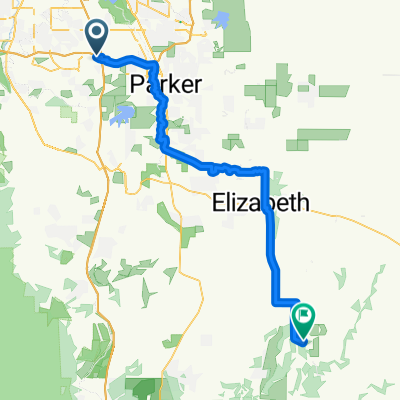
Overview
About this route
- -:--
- Duration
- 65.3 km
- Distance
- 643 m
- Ascent
- 646 m
- Descent
- ---
- Avg. speed
- ---
- Max. altitude
Route quality
Waytypes & surfaces along the route
Waytypes
Busy road
49.2 km
(75 %)
Road
9.6 km
(15 %)
Surfaces
Paved
45.5 km
(70 %)
Concrete
27.6 km
(42 %)
Asphalt
12.8 km
(20 %)
Continue with Bikemap
Use, edit, or download this cycling route
You would like to ride p4p 40 mile 2018 or customize it for your own trip? Here is what you can do with this Bikemap route:
Free features
- Save this route as favorite or in collections
- Copy & plan your own version of this route
- Sync your route with Garmin or Wahoo
Premium features
Free trial for 3 days, or one-time payment. More about Bikemap Premium.
- Navigate this route on iOS & Android
- Export a GPX / KML file of this route
- Create your custom printout (try it for free)
- Download this route for offline navigation
Discover more Premium features.
Get Bikemap PremiumFrom our community
Other popular routes starting in Lone Tree
 p4p 40 mile 2018
- Distance
- 65.3 km
- Ascent
- 643 m
- Descent
- 646 m
- Location
- Lone Tree, Colorado, United States
 S. Cherry Creek Trail
- Distance
- 33.4 km
- Ascent
- 141 m
- Descent
- 76 m
- Location
- Lone Tree, Colorado, United States
 C-470: 25 to 285
- Distance
- 20.3 km
- Ascent
- 81 m
- Descent
- 228 m
- Location
- Lone Tree, Colorado, United States
 P4P 60 Mile (2019) B
- Distance
- 95.3 km
- Ascent
- 671 m
- Descent
- 672 m
- Location
- Lone Tree, Colorado, United States
 West Cherry Creek
- Distance
- 22.1 km
- Ascent
- 54 m
- Descent
- 149 m
- Location
- Lone Tree, Colorado, United States
 Parkmeadows to MSR@PV
- Distance
- 77.3 km
- Ascent
- 863 m
- Descent
- 516 m
- Location
- Lone Tree, Colorado, United States
 Home to Clement Park
- Distance
- 24.3 km
- Ascent
- 139 m
- Descent
- 241 m
- Location
- Lone Tree, Colorado, United States
 Lone Tree Littleton Rounder
- Distance
- 39.4 km
- Ascent
- 255 m
- Descent
- 255 m
- Location
- Lone Tree, Colorado, United States
Open it in the app