

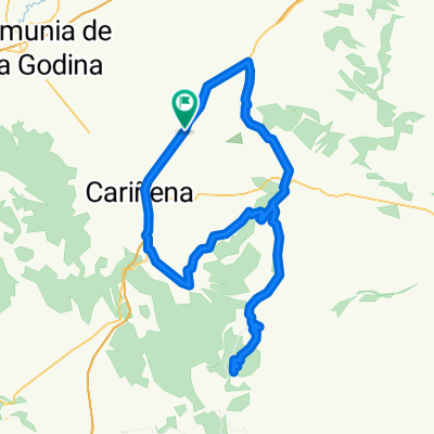
Sierra de Algairen - Longares, Torralbilla, Santa Cruz, Alto de Miedes, Codos, Longares.
A cycling route starting in Longares, Aragon, Spain.
Overview
About this route
Terreno muy duro con constantes repechos. Dos puertos largos (Aguarón y Codos) y tres puertos menores adicionales.
- -:--
- Duration
- 137.1 km
- Distance
- 2,046 m
- Ascent
- 2,050 m
- Descent
- ---
- Avg. speed
- 1,053 m
- Max. altitude

Route quality
Waytypes & surfaces along the route
Waytypes
Busy road
77.9 km
(57 %)
Road
29.3 km
(21 %)
Surfaces
Paved
12.8 km
(9 %)
Unpaved
0.4 km
(<1 %)
Asphalt
12.1 km
(9 %)
Paved (undefined)
0.7 km
(<1 %)
Continue with Bikemap
Use, edit, or download this cycling route
You would like to ride Sierra de Algairen - Longares, Torralbilla, Santa Cruz, Alto de Miedes, Codos, Longares. or customize it for your own trip? Here is what you can do with this Bikemap route:
Free features
- Save this route as favorite or in collections
- Copy & plan your own version of this route
- Split it into stages to create a multi-day tour
- Sync your route with Garmin or Wahoo
Premium features
Free trial for 3 days, or one-time payment. More about Bikemap Premium.
- Navigate this route on iOS & Android
- Export a GPX / KML file of this route
- Create your custom printout (try it for free)
- Download this route for offline navigation
Discover more Premium features.
Get Bikemap PremiumFrom our community
Other popular routes starting in Longares
 Longares-Codos-Paniza-Longares
- Distance
- 71.4 km
- Ascent
- 881 m
- Descent
- 881 m
- Location
- Longares, Aragon, Spain
 Sierra de Algairen - Longares, Torralbilla, Santa Cruz, Alto de Miedes, Codos, Longares.
- Distance
- 137.1 km
- Ascent
- 2,046 m
- Descent
- 2,050 m
- Location
- Longares, Aragon, Spain
 CAMPEONATO ARAGON MASTER
- Distance
- 72.7 km
- Ascent
- 872 m
- Descent
- 873 m
- Location
- Longares, Aragon, Spain
 1ª ETAPA CHALLENGE ARAGON MASTER 2013
- Distance
- 8.6 km
- Ascent
- 64 m
- Descent
- 14 m
- Location
- Longares, Aragon, Spain
 Vuelta a Paniza, Virgen del Aguila, Codos y Almonacid
- Distance
- 98.7 km
- Ascent
- 994 m
- Descent
- 992 m
- Location
- Longares, Aragon, Spain
 Puertos en Sierra Algairen
- Distance
- 137.4 km
- Ascent
- 1,945 m
- Descent
- 1,945 m
- Location
- Longares, Aragon, Spain
 Sierra de Algairen y El Frasno
- Distance
- 151.8 km
- Ascent
- 1,554 m
- Descent
- 1,554 m
- Location
- Longares, Aragon, Spain
 Longares-Mezalocha-Aguilon-Virgen de Herrera-Tosos-Paniza-Longares
- Distance
- 120.4 km
- Ascent
- 1,030 m
- Descent
- 1,034 m
- Location
- Longares, Aragon, Spain
Open it in the app