
Z-Z_03
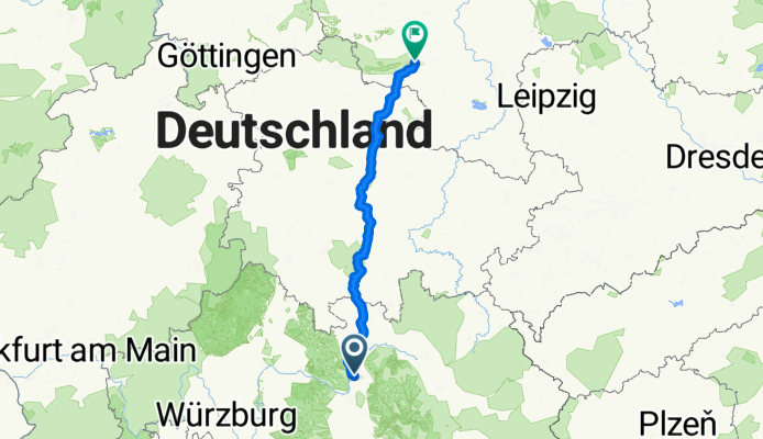
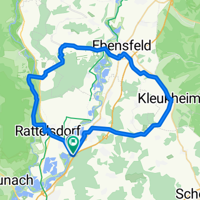
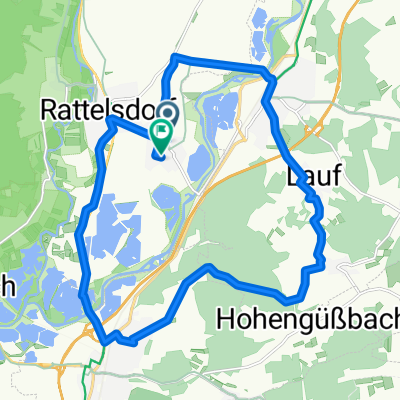
A cycling route starting in Rattelsdorf, Bavaria, Germany.
Overview
About this route
Ziel: Ort, an welchem Wildcamping möglich sein sollte (nördlich von Riedstedt)
- -:--
- Duration
- 222.8 km
- Distance
- 939 m
- Ascent
- 874 m
- Descent
- ---
- Avg. speed
- ---
- Max. altitude

Route quality
Waytypes & surfaces along the route
Waytypes
Road
60.2 km
(27 %)
Track
31.2 km
(14 %)
Surfaces
Paved
153.7 km
(69 %)
Unpaved
8.9 km
(4 %)
Asphalt
144.8 km
(65 %)
Paved (undefined)
4.5 km
(2 %)
Continue with Bikemap
Use, edit, or download this cycling route
You would like to ride Z-Z_03 or customize it for your own trip? Here is what you can do with this Bikemap route:
Free features
- Save this route as favorite or in collections
- Copy & plan your own version of this route
- Split it into stages to create a multi-day tour
- Sync your route with Garmin or Wahoo
Premium features
Free trial for 3 days, or one-time payment. More about Bikemap Premium.
- Navigate this route on iOS & Android
- Export a GPX / KML file of this route
- Create your custom printout (try it for free)
- Download this route for offline navigation
Discover more Premium features.
Get Bikemap PremiumFrom our community
Other popular routes starting in Rattelsdorf
 2016 Bayern Tour,Ebing-Bamberg-Aischtal Medlos
- Distance
- 54.6 km
- Ascent
- 104 m
- Descent
- 79 m
- Location
- Rattelsdorf, Bavaria, Germany
 B9a: Ebing - Birnbaum, 73km 330hm
- Distance
- 73 km
- Ascent
- 426 m
- Descent
- 375 m
- Location
- Rattelsdorf, Bavaria, Germany
 SUP_MTB Ebing
- Distance
- 30.6 km
- Ascent
- 301 m
- Descent
- 303 m
- Location
- Rattelsdorf, Bavaria, Germany
 Itz-Main-Bergtour
- Distance
- 105.7 km
- Ascent
- 1,624 m
- Descent
- 1,562 m
- Location
- Rattelsdorf, Bavaria, Germany
 Bamberg bis Rothenburg
- Distance
- 151.3 km
- Ascent
- 319 m
- Descent
- 176 m
- Location
- Rattelsdorf, Bavaria, Germany
 От Ebinger Marktplatz до Ebinger Marktplatz
- Distance
- 19.7 km
- Ascent
- 156 m
- Descent
- 157 m
- Location
- Rattelsdorf, Bavaria, Germany
 Z-Z_03
- Distance
- 222.8 km
- Ascent
- 939 m
- Descent
- 874 m
- Location
- Rattelsdorf, Bavaria, Germany
 Oberfranken_Rügen Tag1 von 5
- Distance
- 115.8 km
- Ascent
- 937 m
- Descent
- 855 m
- Location
- Rattelsdorf, Bavaria, Germany
Open it in the app