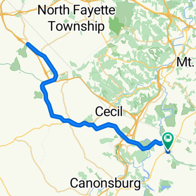
St.Louis MO - Oak Court VA from 390km_Hendersonville
A cycling route starting in Thompsonville, Pennsylvania, United States of America.
Overview
About this route
St.Louis MO - Oak Court VA from 390km_Hendersonville
- -:--
- Duration
- 389.5 km
- Distance
- 1,851 m
- Ascent
- 2,031 m
- Descent
- ---
- Avg. speed
- ---
- Avg. speed
Continue with Bikemap
Use, edit, or download this cycling route
You would like to ride St.Louis MO - Oak Court VA from 390km_Hendersonville or customize it for your own trip? Here is what you can do with this Bikemap route:
Free features
- Save this route as favorite or in collections
- Copy & plan your own version of this route
- Sync your route with Garmin or Wahoo
Premium features
Free trial for 3 days, or one-time payment. More about Bikemap Premium.
- Navigate this route on iOS & Android
- Export a GPX / KML file of this route
- Create your custom printout (try it for free)
- Download this route for offline navigation
Discover more Premium features.
Get Bikemap PremiumFrom our community
Other popular routes starting in Thompsonville
- Slow ride in Canonsburg
- Distance
- 13.1 km
- Ascent
- 179 m
- Descent
- 182 m
- Location
- Thompsonville, Pennsylvania, United States of America
- Recovered Route
- Distance
- 13.3 km
- Ascent
- 183 m
- Descent
- 153 m
- Location
- Thompsonville, Pennsylvania, United States of America
- Miday
- Distance
- 78.3 km
- Ascent
- 535 m
- Descent
- 538 m
- Location
- Thompsonville, Pennsylvania, United States of America
- 5 Georgetown Rd, Canonsburg to 5 Georgetown Rd, Canonsburg
- Distance
- 17.4 km
- Ascent
- 138 m
- Descent
- 145 m
- Location
- Thompsonville, Pennsylvania, United States of America
- test 1
- Distance
- 68.4 km
- Ascent
- 599 m
- Descent
- 599 m
- Location
- Thompsonville, Pennsylvania, United States of America
- Valleybrook Rd, Canonsburg to Valleybrook Rd, Canonsburg
- Distance
- 16.2 km
- Ascent
- 95 m
- Descent
- 91 m
- Location
- Thompsonville, Pennsylvania, United States of America
- Recovered Route
- Distance
- 29.5 km
- Ascent
- 289 m
- Descent
- 299 m
- Location
- Thompsonville, Pennsylvania, United States of America
- Arrowhead Trail / Montour Trail to Clifton Rd
- Distance
- 8.9 km
- Ascent
- 227 m
- Descent
- 139 m
- Location
- Thompsonville, Pennsylvania, United States of America
Open it in the app