chiang mai tag 2
A cycling route starting in Mae Tha, Lamphun, Thailand.
Overview
About this route
- -:--
- Duration
- 55 km
- Distance
- 288 m
- Ascent
- 501 m
- Descent
- ---
- Avg. speed
- ---
- Max. altitude
Route quality
Waytypes & surfaces along the route
Waytypes
Road
32.4 km
(59 %)
Quiet road
18.7 km
(34 %)
Surfaces
Paved
35.7 km
(65 %)
Unpaved
1.1 km
(2 %)
Asphalt
34.1 km
(62 %)
Concrete
1.6 km
(3 %)
Continue with Bikemap
Use, edit, or download this cycling route
You would like to ride chiang mai tag 2 or customize it for your own trip? Here is what you can do with this Bikemap route:
Free features
- Save this route as favorite or in collections
- Copy & plan your own version of this route
- Sync your route with Garmin or Wahoo
Premium features
Free trial for 3 days, or one-time payment. More about Bikemap Premium.
- Navigate this route on iOS & Android
- Export a GPX / KML file of this route
- Create your custom printout (try it for free)
- Download this route for offline navigation
Discover more Premium features.
Get Bikemap PremiumFrom our community
Other popular routes starting in Mae Tha
- Mae Tha - Ko Kha
- Distance
- 66.4 km
- Ascent
- 960 m
- Descent
- 1,128 m
- Location
- Mae Tha, Lamphun, Thailand
- Baan Phupona - Lampang
- Distance
- 52.7 km
- Ascent
- 248 m
- Descent
- 449 m
- Location
- Mae Tha, Lamphun, Thailand
- Mae Tha - Long
- Distance
- 89.6 km
- Ascent
- 318 m
- Descent
- 694 m
- Location
- Mae Tha, Lamphun, Thailand
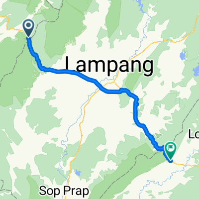
- Chiang Mai-Lamphun CLONED FROM ROUTE 392005
- Distance
- 57.9 km
- Ascent
- 58 m
- Descent
- 185 m
- Location
- Mae Tha, Lamphun, Thailand
- chiang mai tag 2
- Distance
- 55 km
- Ascent
- 288 m
- Descent
- 501 m
- Location
- Mae Tha, Lamphun, Thailand
Open it in the app